Thursday, July 12, 2018

Day #43: Up the Hudson to Mechanicville, NY

Just a few miles above Waterford we're all alone on the Hudson. Could the area have looked much different in the 1800's?

We share the ride through Champlain Lock 1 with the tug Margot.

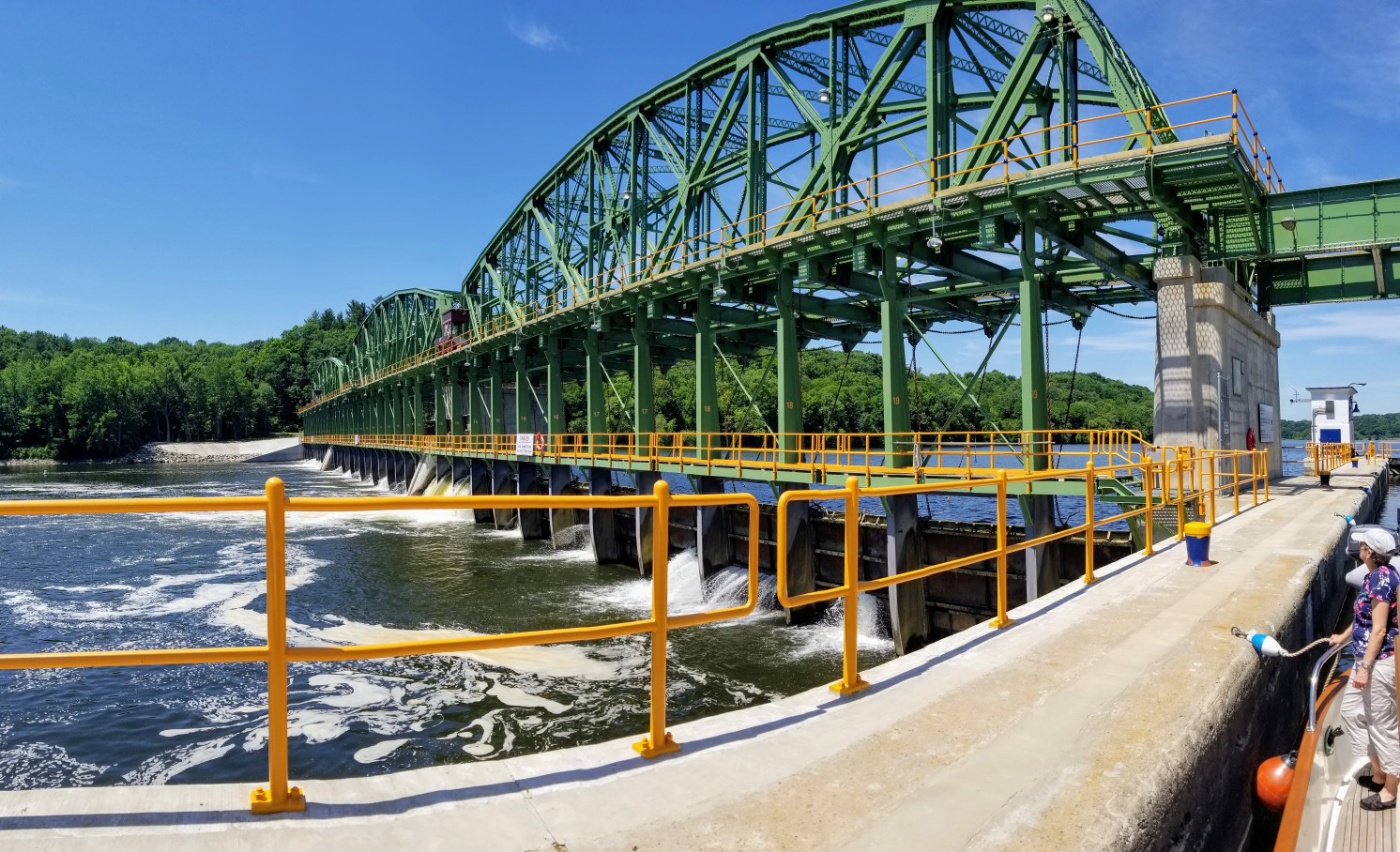
 Lock 1 is around a tight bend, so you don't see it until you're about a quarter mile away.  When Nellie is a mile out Bicki calls the lock on the VHF. She's told that the tug Margot and her barge are transiting the lock and to expect a 45 minute delay. No sweat we think; that's a lot better than the two hour delays common on the Mississippi. Rounding the bend just before the lock we see three things: the lock is in a narrow canyon; its doors are open and; Margot isn't in view. "Ah, Lock 1, this is the Nellie D., where's Margot?" Before we hear a reply we see Margot under full steam rounding the bend behind us. We're in a bottle and Margot is the cork. There's no room to starboard so Nellie moves to port and hugs the wall just outside the lock. The lock master advises us to stay as far back on the approach wall as possible so as to give Margot room to pass. We do and Margot easily slides by--death and destruction averted--whew. The whole event was a comedy of errors. The lock master thought Margo was pushing a barge and we thought Margo was infront of us. For her part, Margo was just amused by the episode and invited us to join her in the lock for the ride up.

The approach to Lock 2 is wide open.

On the wall in Mechanicville.

Eight miles between Waterford, NY and Mechanicsville, NY.

Safely tied to the free wall in Mechanicville, NY. DBH

Wednesday, July 11, 2018

Day #42: Boat Chores in Waterford, NY

Looking southeast at the Waterford town docks.

Waterford was the navigable limit for large boats traveling up the Hudson River. That changed in 1823 with the opening of the Champlain Canal. This 90 mile long, 11 lock canal connects the Hudson River to Lake Champlain.

The Champlain Canal (credit champlaincanal.net)

Now, after three weeks on the Erie Canal, it's time for Nellie to turn left and head up the Hudson on the Champlain Canal. But first we'll take a down day to get some boat chores done.

Still tied to the wall in Waterford, NY. DBH

Tuesday, July 10, 2018

Day #41: Down The Flight of Locks to Waterford, NY

A vast Expanse on the Mohawk River.
A truck crosses the I-87 bridge. Erie Canal meet your competition.
Sunny, warm, calm and scenic.

Curves.

The last Erie Canal Lock opens to reveal the Canal's eastern end at confluence of the Mohawk and Hudson Rivers.

It's quite a surprise after being in a very wide and slumbering Mohawk River to be shunted off to a narrow, walled, and highly concreted canal. It's all for the best though as the alternative is to go over the 90' high Cohoes Falls--that would ruin our day. Instead we follow a 1-1/2 mile long concrete ribbon through 5 locks. Together they lower Nellie 168'. When the last lock door opens we're looking at the confluence of the Mohawk and Hudson Rivers. While this is where the Erie Canal officially begins, it represents the end of our 540 mile journey along what Hawthorne called the "mud puddle."


17 miles Schenectady, NY to Waterford, NY

Happily tied to the town wall in Waterford, NY. DBH

Monday, July 9, 2018

Day #40: Short Trip to Schenectady, NY

Miss. Willobghy and Nellie D. enjoy a two tug rendezvous at the Schenectady Yacht Club.

This is one of the reasons we only went four miles today, the Yacht Club's pool.

The Yacht Club also has a dry storage area.  My guess is that this boat has been on the hard more than a year...

Four miles from Scotia, NY to Schenectady, NY

For a piece of nostalgia here's a recording of Thomas S. Allen's Erie Canal Song (circa 1905).

Nellie is enjoying her day off in Schenectady, NY.  DBH

Sunday, July 8, 2018

Day #39: Through the Appalachians to Scotia, NY

The Mohawk Valley is beautiful and reminds us of the Upper Mississippi, only without towboats, current or wing dams...

It seems that every hamlet, village, town and city along the Erie Canal has a historical house that claims "Washington slept here." There are so many in fact that one starts to wonder if George had time to do anything else. The fact is, he didn't lead from the rear. His forays into the hinterland gave him first-hand knowledge of the terrain. Bernstein points out, in Wedding of the Waters, that Washington's strategic vision went well beyond war with the British. Washington foresaw a time when Americans, divided by the impenetrable Appalachians could split into two nations. The remedy he said was to bind the union with commerce and facilitating transportation was the key. Washington didn't live to see the Erie Canal built but he was one of the visionaries who argued for and saw its great potential.

The Erie Canal, from Buffalo to Albany, is possible because the Mohawk Valley is a lowland route through the Appalachian Mountains. (Wikipedia image)

The dam at Lock 11 across a very wide Mohawk River lowers us 12'.

40 Miles Canajoharie, NY to Scotia, NY

Safely tied to the dock in a very lovely park in Scotia, NY. DBH

Saturday, July 7, 2018

Day #38: The Mohawk Valley Narrows in Canajoharie, NY

Looking East in the Little Falls Lock #17 .  At 40' this is the Largest Lift on the Erie Canal.   It's also the Only Lock with a Guillotine Style Lower Gate 

Looking South at the Canal-side, Georgian-style Home of Brigadier General Nicholas Herkimer, Revolutionary War Hero in the Battle of Oriskany where he halted the British Advance Down the Mohawk Valley.  Wounded in the Leg at Oriskany He Died 10 Days Later After a Botched Amputation by Benedict Arnold's Surgeon

Looking North from the Herkimer Home.  In the 1800's Train Tracks Ran just Beyond and Parallel to the White Picket Fence.  Just Beyond the Tracks was the 1817 Erie Canal.  Both are Gone Now.  The Mohawk River, and Route of the Current Erie Canal is at the Top of the Picture

Thistles where Once Crops Grew

A Rarity on the Erie Canal a Real Working Towboat and Barge

Nellie Scored the Last Spot on Canajoharie's Free Dock

An Advertisement Featuring a Picture of Canajoharie and the Beech-Nut Plant

In almost every town from Buffalo West we've seen idle manufacturing plants.  Canajoharie suffers from the same fate but only worse because it's built around the huge, and now shuttered, Beech-Nut plant.  The 118 year old facility, which employed 350, was closed in 2009 when a new, state-of-the-art replacement was built 20 miles away in Florida, NY.  The new plant employs 135 people.

19 Miles Little Falls, NY to Canajoharie, NY

Safely tied to the dock in Canajoharie, NY.  DBH

Friday, July 6, 2018

Day #37: Into the Mohawk Valley to Little Falls, NY

Just East of Utica Heading into Lock 19


It's a Long, Narrow, Current Swept Exit from Lock 19.  Too Rattle Our Nerves a Little more a Train Passed Overhead


The Terrain Changes dramatically in the Mohawk River Valley


In these Buildings were Made the Blue Uniforms Worn by Union Soilders During the Civil War


Nellie Finds a Spot on Lock 17's Wall Just South of the Little Falls Hydroelectric Plant


22 Miles from Utica, NY to Little Falls, NY


It's often commented on that he Western portion of the Erie Canal is very different than the Eastern. Between Buffalo and Lake Oneida the Canal makes lots of twists and turns and goes through a cute hamlet every handful of miles. Conversely, the Eastern Erie has lots of straightaways and skims by the outskirts of bigger and more spread out towns. The difference, I think, is mostly a result of the 1900's canal enlargedment. The new canal was rerouted with steam powered vessels in mind. Tow paths and the mules that trod upon them were no longer required. Neither were all the services that the hamlets provided.

I'm happy to report that the heat spell has broken. We celebrated by walking three miles in each Utica and Little Falls. DBH