Saturday, July 7, 2018

Day #38: The Mohawk Valley Narrows in Canajoharie, NY

Looking East in the Little Falls Lock #17 .  At 40' this is the Largest Lift on the Erie Canal.   It's also the Only Lock with a Guillotine Style Lower Gate 

Looking South at the Canal-side, Georgian-style Home of Brigadier General Nicholas Herkimer, Revolutionary War Hero in the Battle of Oriskany where he halted the British Advance Down the Mohawk Valley.  Wounded in the Leg at Oriskany He Died 10 Days Later After a Botched Amputation by Benedict Arnold's Surgeon

Looking North from the Herkimer Home.  In the 1800's Train Tracks Ran just Beyond and Parallel to the White Picket Fence.  Just Beyond the Tracks was the 1817 Erie Canal.  Both are Gone Now.  The Mohawk River, and Route of the Current Erie Canal is at the Top of the Picture

Thistles where Once Crops Grew

A Rarity on the Erie Canal a Real Working Towboat and Barge

Nellie Scored the Last Spot on Canajoharie's Free Dock

An Advertisement Featuring a Picture of Canajoharie and the Beech-Nut Plant

In almost every town from Buffalo West we've seen idle manufacturing plants.  Canajoharie suffers from the same fate but only worse because it's built around the huge, and now shuttered, Beech-Nut plant.  The 118 year old facility, which employed 350, was closed in 2009 when a new, state-of-the-art replacement was built 20 miles away in Florida, NY.  The new plant employs 135 people.

19 Miles Little Falls, NY to Canajoharie, NY

Safely tied to the dock in Canajoharie, NY.  DBH

Friday, July 6, 2018

Day #37: Into the Mohawk Valley to Little Falls, NY

Just East of Utica Heading into Lock 19


It's a Long, Narrow, Current Swept Exit from Lock 19.  Too Rattle Our Nerves a Little more a Train Passed Overhead


The Terrain Changes dramatically in the Mohawk River Valley


In these Buildings were Made the Blue Uniforms Worn by Union Soilders During the Civil War


Nellie Finds a Spot on Lock 17's Wall Just South of the Little Falls Hydroelectric Plant


22 Miles from Utica, NY to Little Falls, NY


It's often commented on that he Western portion of the Erie Canal is very different than the Eastern. Between Buffalo and Lake Oneida the Canal makes lots of twists and turns and goes through a cute hamlet every handful of miles. Conversely, the Eastern Erie has lots of straightaways and skims by the outskirts of bigger and more spread out towns. The difference, I think, is mostly a result of the 1900's canal enlargedment. The new canal was rerouted with steam powered vessels in mind. Tow paths and the mules that trod upon them were no longer required. Neither were all the services that the hamlets provided.

I'm happy to report that the heat spell has broken. We celebrated by walking three miles in each Utica and Little Falls. DBH

Thursday, July 5, 2018

Day #36: When in Rome... Run to Utica, NY

For 40 Miles East of Sylvan Beach the Canal is Nothing but Man-made Straightaways


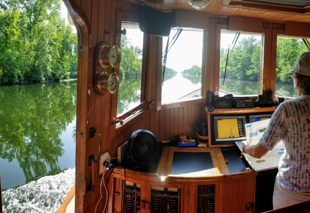
At the Helm of the Lois McClure
  

We stopped in Rome, NY to see the glass blowing demonstration aboard the Corning Glass Barge. The barge is currently moving west on the Erie Canal. Traveling with the barge is the Lois McClure, a replica of an 1862 schooner/canal boat. It was nice to finally see a canal boat after reading so much about them.

Fun Fact: On July 4th, 1818 the Erie Canal's Construction began in Rome, NY.


Shore Side Power Pedestals--Rare as Hens Teeth


28 Miles from Sylvan Beach, NY to Utica, NY


Today we ran from Rome, which doesn't have dockside power, to Utica, which does. It's a crazy way to explore the Canal but when it's 94°F crazy starts making sense. DBH

Wednesday, July 4, 2018

Day #35: How Could We Not Stop in Sylvan Beach, NY

East onto Lake Oneida and into the Rising Sun.  But First, Under the Highway 81 Bridge


Dressing Ship on the Wall in Sylvan Beach


On Sylvan Beach.  Toes in the water.  Under the Umbrella.  Looking Out at the Boats Looking in at Us


Oh, that's Why it's Called Sunset Park


22 Miles from Brewerton, NY to Sylvan Beach, NY


On the approach to Sylvan Beach we're greeted by a flood of Lake-bound boaters. Pontoon boats, cabin cruisers, jet skis, kayaks, sailboats, bass boats, home mades, dinghys, you name it, it was streaming past. The destination for most is the anchorage just off the town's beach. In no more than four feet of water they drop both bow and stern hooks to keep their transoms facing the beach. Their crews, apparently given shore leave, disembark wearing their best swimming attire. It's a mob scene. It's fun. Happy 4th of July. DBH

Tuesday, July 3, 2018

Day #34:. Looking for a Home in Brewerton, NY

Happy 3rd of July...


Syracuse's Inner Harbor is going through what city planners call a "revitalization." While it's still in the early phases, the docks are open (with electrical power) and visitors are welcome. ActiveCaptain--think AAA guide for cruisers--warned of several low bridges on the approach and questionable water depths near the docks. Before leaving Baldwinsville this morning I asked several boat neighbors if they'd visited the Inner Harbor. One had, said it was fine, but warned of pilings that had been cutoff just below the waterline. Apparently a friend of his discovered them when the bow of his boat was uncerimoniously lifted up and out of the water. Cautioned but undeterred we pressed on. Lake Onondaga, just north of Syracuse is a study in contrasts. The northwest side is a nature reserve while the southeast side has been heavily industrialized since the 1800's. The Inner Harbor is accessed by going up Onondaga Creek. The really muddy water was the first thing we noticed about the creek. To quote Hawthorne, "..as dark and turbid as if every kennel in the land paid contribution to it." Thankful, according to Wikipedia, the actual explanation is less foul:

Approximately 18 miles south of Syracuse, the Tully Valley has unique hydro-geological features called mudboils. These mudboils are the cause of the excessive sedimentation of Onondaga Lake. The sediment enters Onondaga Creek, which flows north into the lake. Sediment loading is a problem because it degrades water quality, decreases water clarity, and reduces habitat for aquatic insects, fish spawning, and plants.

Nellie's keel discovered the "excessive sedimentation" when she was 100 yards from the docks. Sometimes retreat is the best course, at least I'd like to think so, as that's what we did.


The Audience Assembles for the Fireworks

35 Miles From Baldwinsville, NY to Brewerton, NY

After bailing on the Inner Harbor we headed to Brewerton. The town's south wall had plenty of room and so we put in expecting a quiet night. Wrong. Little did we know that we were front and center for the evening's fireworks display. At 6 pm folks started to assemble. By 9 pm it was a zoo. By midnight we got to sleep. All-in-all an unexpected but welcome bonus. DBH

Monday, July 2, 2018

Day #33: On to Baldwinsville, NY

Bicki Clears an Accumulation of Water Weeds from Near the Propeller. During this Morning's Engine Check I Found the Raw Water Strainer Half Full of Grass

Sometimes the Water is so Calm That it's Hard to Tell where the Water Ends and the Trees Begin

The Original Erie Canal had Two Aqueducts. Who Knew? Pictured Above is the Richmond Aqueduct. It Once Carried Packet Boats Over the Seneca River. When the Canal was Enlarged the Aqueducts were Abandoned. (Photo Credit Montezuma Heritage Park)

Cruising isn't for Everyone. You need Grit, Stamina, Nerves of Steel and, Most Importantly, You Need to Know when to Relax :-)

Yesterday I wrote about how easy it is to cruise the Erie Canal. Nathaniel Hawthorne's, "The Canal", which first appeared in New-England Magazine, December, 1835, makes the same observation, but says it oh, so much better. I heartily recommend Hawthorne's entire article to you.

Bound to a distant port, we had neither chart nor compass, nor cared about the wind, nor felt the heaving of a billow, nor dreaded shipwreck, however fierce the tempest, in our adventurous navigation of an interminable mud-puddle -- for a mud-puddle it seemed, and as dark and turbid as if every kennel in the land paid contribution to it.


Thunderstorms can be a Welcome Event. Especially when it's 100°F when they Roll In

37 Miles from Seneca Falls, NY to Baldwinsville, NY

We didn't see many cruisers moving about today. In our imaginations they were huddled below decks enjoying their air conditioning loathe to give up the scarce, shoreside power outlets which made the comfort possible. Luckily, upon arrival in Baldwinsville, there was a single spot on the wall with the coveted power pedestal. DBH

Day #32: Melting in Seneca Falls

Safely Tied to Seneca Falls' Wall.   It's Not Often that Nellie gets a Spot in the Shade

Keeping cool while underway hasn't been an issue. The breeze and the 73°F canal water keep things comfortable aboard Nellie. When Nellie stops, however, we really feel the heat. For those occasions there are three lines of defense: first are the fans; second is the 14,000 Btu air-conditioner; third is both the fans and air conditioner working in conjunction. Yesterday it was "all hands on deck" as the temperature rose above 100°F.


A Walk in the Park (Along the Old Railroad Line)


Paying Homage to Seneca Falls' Role in Providing Pumps to the World


Seneca Falls, NY

Canal cruising is easy in that you don't have to worry about the sea state or the winds. Nor do you have to worry (as much) about breaking down because both parts and help are always close by. So too are good moorings, grocery stores, and restaurants. Yup, canal cruising is pretty good. This heatwave has highlighted one issue: marinas on the canal are rare as hens teeth. While we normally try to avoid marinas, during a heatwave they, or more specifically their 120V power, are a harbor of refuge. Until this heatwave breaks Nellie will be cruising between 120V outlets. Problem is, so are all the other boats and there are too few outlets for all of us. Still in Seneca Falls, NY. DBH