Monday, July 8, 2019

Day #26: Ft. Edward (sur Hudson)


Fixer-upper for sale. Basement has small drainage problem.


Channel markers are a wonderful thing. They indicate the location of navigable water and if you're heading into or out of port. The pictured marker's placement is curious. Would anyone really think navigable water is over the rocks and through woods?


 A little farther down the canal is a big sign marked "CHANNEL" with an arrow pointing to the right. Hmm, a red channel marker says the same thing and is easier to place and maintain. Oh well, it's probably best to file the logic of channel mark placement in the unfathomable category.


We reached 140' above sea level, the Champlain Canals summit, between locks 9 and 10. It's all down hill from here.

On Ft Edwards free wall. 25 miles today, 636 miles into 2019 and 8871 miles from Naples. DBH

Saturday, July 6, 2019

Day #25: Whitehall, NY


Heading south the Adirondacks and Green mountains start pressing tightly against Lake Champlain. The Lake narrows and the mountains tumble right to the water's edge. Cliffs and bluffs abound.

As we glide past Fort Ticonderoga I can almost see Colonel Henry Knox, his men and his mule teams. It's December 1775 and they're struggling mightily hauling 59 cannons which Washington so desperately needs in the battle for Boston.


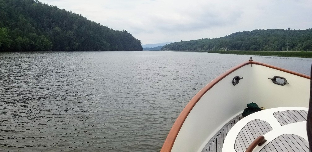
Traveling farther south the Lake starts feeling more like a river, and then like a humble stream.


Upon docking in Whitehall Bicki says, "I love New York."


What she actually means is, "I love Whitehall's free dock, water and electric." Hard to argue with that.


On Whitehall's free wall just south of Lock 12. 37 miles today, 612 in 2019 and 8847 miles from Naples. DBH

Friday, July 5, 2019

Day #24: Chimney Point, VT

There has been little correlation between forecasted (3 mph) and actual (20 mph) wind speeds.  A saving grace is the relatively calm sea state and that we're going directly into it. Still, we closed the wheelhouse windows when the water started flying.

There are three kinds of humans: the living; the dead; and those that go to sea -- Aristotle


Today's anchorage. Although a day late, a very 4th of July picture.

The Crown Point monument honoring Champlain for his 1609 explorations. Just above the plaque is a small bust of Champlain by Auguste Rodin.

Looking north up Lake Champlain and across what remains of the English's Crown Point fort.

File this under ingenious inventions. Barnes' 1826, two horse-powered ferry which ran the 1.5 miles between Chimney Point, VT and Port Henry, NY.

Nellie's ground tackle: a vertical windlas; 3/8" BBB chain; wash down hose; rope bridle; 8' boat hook; and the star of the show, not seen as it's on the bottom doing its job, the 80lb Babeth anchor.

At anchor in Chimney Point, VT. 35 miles today, 575 miles in 2019 and 8810 miles since leaving Naples. DBH

Thursday, July 4, 2019

Day #23: Willsboro Bay, NY

A calm, hazy and, most surprisingly, traffic free day in the middle of Lake Champlain.
 
We toured SW Mallets Bay in the kayaks and then SE Mallets Bay with Nellie. I now know where the folks from Burlington, Vermont's largest city, keep their boats. The SE Bay is chock-a-block with marinas and mooring balls.

Tonight we're anchored in the south end of Willsboro Bay. Willsboro is a fjord and its west side is mostly rugged, high, cliffs.

27 miles today, 540 miles into 2019 and 8777 miles from Naples. DBH

Wednesday, July 3, 2019

Day #22: Thayer Beach, VT


At anchor off Thayer Beach.

Yesterday, while going through the cut in the Mallets Bay causeway, I  expected some skinny water.  It wasn't, but why?

Lake, like ocean cruising is very much a three dimensional game. The depths shown on chart above are based on the lake being 93' above sea level. However, this morning's lake level is 97.74', almost 5' feet higher than the charts indicate. High water is like money in the bank--it can keep you from going high and dry on the shoals of ignorance.

A quiet Thayer Beach anchorage.

On the hook in Thayer Beach, VT. 14 miles today, 512 miles in 2019, and 8751 miles from Naples. DBH

Tuesday, July 2, 2019

Day #21: Historical Plattsburgh, NY


Up early we head south to Plattsburgh. Marina space can be tight this close to the 4th but we score a slip right up front in the Boat Basin.

Bicki and I are curious to see Plattsburgh because until 1995 there was an Air Force Base here. Strategic Air Command (SAC) based B-52s, FB-111s and KC-135s here.

This Monument commemerates Commodore Thomas Macdonough's 1814 victory over the British Fleet in the Battle of Plattsburgh. Without naval superiority the invading British army had to retreat back to Canada.

A porcelain mosaic on a building in downtown Plattsburgh.

A B-47 static display on what was Plattsburgh AFB. The base is being redeveloped but yet retains that distinctive military flavor. What was officer's row--a long line beautiful old brick homes lining the parade ground--is now privatized. Soccer and lacrosse are the games now being played on the still well manicured fields.

9 miles today, 497 miles in 2019 and 8737 from Naples. DBH

Monday, July 1, 2019

Day #20: Hello USA


Just down the Richilieu River is the US/Canada border. Thanks to the Seven Years' War (1756-1763)--aka the French and Indian War--the boundary between New York, Vermont and Quebec is set at the 45th parallel. In the above picture Nellie's GPS reports our lattitude as 45° 16'. Since 1' equals 1 nautical mile (nm), we're 16 nm north of the border. However, there's always a "however", all signatories to the peace treaty agreed to abide by the survey markers which are close, but not exactly on, the 45th parallel.

US Customs and Border Patrol encourages boaters to use its ROAM app to expedite the check-in process. An hour before crossing the border I fired up the app, answered the usual questions and then crossed my fingers. I received a pre-clearance number quickly but then waited for a CBP agent's review. About 15 minutes later the app instructed us to stop at Rouses Point and check-in. Oh well. What piqued CBP's interest was my answering "yes" to the app's question about there being any meats, vegetables or fruits aboard. Face to face we copped to having all three. The nice, young agent said it wasn't a problem and sent us on our way. In the end, it took longer to dock the boat than to clear-in.

Tonight we're on a mooring in Point Au Roche State Park, NY. The GPS says 44°46', which is 14nm, give or take, south of the border.

43 miles today, 489 miles in 2019 and 8728 from Naples. DBH