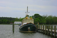
Thursday, December 31, 2009
31 December - Day #29. Today is dedicated to provisioning, laundry and a Walmart run. Dad drives us all around and we even tour some of Savannah's very scenic areas. Many of the roads are beautifully canopied by live oaks. Wisps of tinsel-like Spanish moss hang from almost every branch. We have cocktails aboard before going out for a New Year's celebratory dinner with Dad and Claire. Safely at the dock in Sail Harbor Marina, Savannah, GA. 0nm today/670nm total. DBH
Wednesday, December 30, 2009
30 December - Day #28. Tomorrow there's a blue moon so the tidal range is near maximum--8' here in southern SC. This makes the 1.5 mile long Field's Cut, already infamous on the ICW, all the more challenging. Among its charms are rapid tidal flows, very shallow water, and of course, there's no maneuvering room because it's hallway narrow. Naturally we arrive at the gauntlet just before low tide. Several hundred yards into the Cut we see a sailboat aground. He asks us to wake him, i.e. to go by quickly so our wake will give him a few seconds of altitude to try and free himself. We offer to pull him off but he decides to wait for the tide to rise. Definitely a safer decision. What's left of the ebb is pushing us down the Cut so if we do go aground it'll be all that much more dramatic. The Cut's southern exit is by far the shallowest section. At idle, but with the tide pushing us at 5kts, we skim over a bottom which is just a foot under our keel. Safely at the dock in Sail Harbor Marina, Savannah, GA. 46nm today/670nm total. DBH
Tuesday, December 29, 2009
29 December - Day #27. Some days it's better not to plan--just go and see what happens. We pulled the anchor in Charleston, headed south, and had the current behind us almost the entire trip. Nellie D. acted like a race horse when she was pushed along at 9.6 knots in the N. Edisto River. It was all very relaxing with opportunities for naps and reading when not on watch. We saw only a few other boats along the way, including the "Earth Ball" which is pictured above. The skipper looks like he's one go wake away from swimming. I always wonder how close to cut channel markers. Do they mark deep water or shoals? The picture above gives me pause. As for us, we had no particular destination in mind, but with an average speed of 6.5 knots we were pleasantly surprised to be in Beaufort, SC late in the afternoon. Beaufort is another antebellum town with amazing houses and the biggest live oaks I've ever seen. Anchored off Beaufort, SC. 56nm today/624nm total. BJH
Monday, December 28, 2009
December 28 - Day #26. A cruiser thinks about their dink (dingy) like anyone shoreside thinks about their car--its how you get around. Being stranded by a broken down car is never fun, but it's usually not life threatening. If a dink's engine quits in the wrong place it can be disastrous. While we were in Mexico a fellow cruiser was returning from the beach in Cabo San Lucas to his boat anchored just off shore. When his engine quit he got the oars out. To his horror no amount of effort could overcome the wind and current--he was going out to sea. Luckily, the next day a helicopter found him--12nm offshore. Today, as we dingied back from downtown Charleston, our engine decided to test our mettle in the middle of a mile wide section of the Ashley River. There was a 20kt wind and a strong ebbing current when the engine's RPM dropped off precipitously. Normally an event like this is followed rapidly by the outboard's deafening silence. At this point I'm thinking "No tools and no VHF radio--great." Luckily the Yamaha kept running, albeit at greatly reduced power. The closest refuge was a desolate area of marsh. We headed for it; any port in a storm. Only after getting to within rowing distance did we parallel the marsh and continue heading in Nellie's general direction. After what seemed like an hour we reached a more populated area. Here, just in case, we motored close to the ends of the docks. Nellie never looked so good as we approached. Ok, so realistically our chances of getting swept all the way out of Charleston harbor and into the open Atlantic were slim and none. However, knowing that doesn't keep the adrenalin from flowing when the RPMs drop unexpectedly. The engine's autopsy is inconclusive thus far. Anchored in Wappoo Creek, Charleston, SC. 0nm today, 569 nm to date. DBH
Sunday, December 27, 2009
27 December -- Day#25. It's a relaxing 20 mile trip to Charleston through low marshy grass lands. Rivers and inlets weave aross the ICW in every direction. We see countless dolphins who greet us by leaving their feeding grounds to come play off our bow. Charleston Harbor can be a busy place with countless frieghters, naval ships, fishing boats and the like. This Sunday morning the harbor is nice and quiet with only two tour boats transisting from Liberty Square to Fort Sumter and maybe a dozen or so sailboats enjoying a liesurely day on the harbor. This lack of traffic makes it a perfect day for us to go investigating. We first cruise by Fort Sumter where history claims the Civil War started. Then we head southwest to get a close look at the aircraft carrier Yorktown. Interestingly, it's the most visited tourist attraction in Charleston with over 700,000 visitors a year. Across the Cooper River to Liberty Square we see the aquarium and the maritime museum buildings. With old town Charleston to starboard we round the Battery, on the city's west side, and pass the City Marina. Not ones to pass up a free wifi connection we drift for a few minutes while checking email. It's then time to head to our favorite anchorage just beyond the Wappoo Creek Bascsule Bridge. We cap off a great day cruising by walking to a little strip mall where there's a Chinese Resturant. Anchored in Wappoo Creek, Charleston, SC. 24 nm today, 569 nm to date. BJH
Saturday, December 26, 2009
26 December - Day #24. We set a new record yesterday--a whole .2nm traveled. The Christmas day gale finally blew itself out at 5pm. While we'd planned to cruise to Georgetown, SC, which is 20 miles away, the late hour coupled with the crew's laziness meant we were lucky to get away from the dock and across the river. The tidal range, or the number of feet the tide goes up and down, has increased from the Chesapeake's one foot to five feet here. Running with the current has a dramatic effect on our speed this morning as we see our normal 6.5kts not drop under 8kts for several hours. It may be hard to believe but this speed change is as dramatic to us as going from 65 to 80 mph in a car. This evening's anchorage is just 20 miles from Charleston and is very close to an ocean inlet. We drop the dink and go exploring. The beach, which is only accessible by boat, is great for shelling. Back aboard, Bill and Heidi, S/V Act III, who are coincidentally in the same anchorage, join us for cocktails. At anchor in Price Creek, SC. 55nm today and 545nm total
Friday, December 25, 2009
Merry Christmas! Nellie D. is decorated in honor of the season (Dave's doing) and today we celebrated Christmas aboard. I always love a holiday where I get presents:-) Last night, it was sure nice to have no anchor watch, in fact we slept quite soundly tied to the dock even while the winds kicked up to 25kts. Since we had shore power I figured it was time to do a few loads of laundry aboard and now the saloon is decorated with four clothes lines full of drying clothes--not quite as festive as Dave's decorations. The rain is falling now and we're hoping it will stop when it's time to cut the dock lines early this afternoon. We're off to the anchorage in Georgetown, SC--just 20 miles to the south. At the Dock, Wacca Wache Marina, Murrells Inlet, SC. 0nm today and 489nm total. BJH
Thursday, December 24, 2009
24 December - Day #22. Going through Myrtle Beach we see three boats driven ashore and badly damaged, presumably by last weekend's big winds. To celebrate Christmas, and to pamper ourselves, we pull into the Wacca Wache Marina. There's a pub at the head of the dock so we stop in for some beers and a snack. Everyone was talking about a boat docked in front of the pub. Yup, Nellie stole the spotlight (again). Lots of folks came over to our table to chat and we even met the chef and the owner. As we left the pub another couple stopped us and said that if they ever give up sailing a tug just might do. Turns out Bill and Heidi are off S/V Act III, a Peterson 44 we'd seen earlier today in Myrtle Beach. They left New Hampshire four months ago on a scheduled two and half year cruise-about of the Caribbean and Central America. We chatted a bit and then we were off to their boat for cocktails. I'd planned a nice shrimp dinner, but the shrimp never made it out of the freezer. Instead it was a social evening followed by a bit of left overs. I just laugh when I think of all the interesting people we've met--not because we're so wonderful, but because people love Nellie. What a hoot! At the Dock, Wacca Wache Marina, Murrells Inlet, SC. 37nm today and 489nm total. BJH
Wednesday, December 23, 2009
23 December - Day #21. For several weeks now we've heard Coast Guard alerts and stories from fellow cruisers about the ICW being closed for new bridge construction. Well, today we find out for ourselves. About 5 miles from Southport we see large cranes on barges and some vertical supports. There's a tug moving one of the barges around and we try, without luck, to hail him. Figuring it's better to ask for forgiveness than for permission, and seeing a gap just big enough for Nellie, ok, the Queen Mary too if the truth be told, we slip through. Today's trip is an easy one. There are no scary waters to deal with. So, while not on watch, I get back to documenting Nellie's as-built AC wiring and Bicki buries her nose in Kiran Desai's "The Inheritance of Loss". Just into South Carolina is the second bridge hurdle of the day. The Sunset Beach Pontoon Bridge is being replaced with a very high fixed span. Some local's are protesting the change. The pontoon bridge is the last on the ICW and so it's passing marks the end of an era. While all the other bridges we've gone under open by swinging or raising, this bridge floats and with a series or wire ropes is pulled out of the way. The on-going construction on the new bridge doesn't impede us and we pass, like the pontoon bridge, into the sunset. At Anchor in Calabash Creek, Little River, SC. 29nm today and 452nm total. DBH
Tuesday, December 22, 2009
22 December - Day #20. It's taken almost three weeks but we're starting to get into the cruising groove. This morning, before weighing anchor, we went for a nice long walk in Wrightsville Beach. There was no rush, the ebb tide on the Cape Fear River wasn't until late morning. Today's four hour cruise south is a pretty one. The first two hours are like a canal trip with lots of big houses to look at. The second half of the trip, down the Cape Fear River, is quite different. The river is wide, almost two miles wide in some spots. It can be rough too, especially when the winds oppose a strong current. This stretch of the Cape Fear River is mostly wilderness. It probably hasn't changed much from the early 1700's when tall ships plied the river to Wilmington. Today, with no wind to stir it up, and with a speed boost from the ebb, we made good time. On the west bank of the Cape Fear River, several miles before it empties into the Atlantic, is the seafaring town of Southport, NC. It's quaint, antebellum, and awash in live oaks. Oh ya, it also has several free docks. At the free dock with free electricity ;-) in Southport, NC. 24nm today and 423nm total. DBH
Monday, December 21, 2009
21 December - Day #19. Brrr, it's 27F. Not that I'm complaining, after all, the winds are down. It's 7am and we're off before sunrise. The ICW crosses a live-fire range at Camp Lejeune. Apparently they're sleeping-in so we march right through. Coming under the bridge at Wrightsville Beach we wave to a north bound USCG patrol boat. They did the dreaded u-turn and hailed us on the radio--oh boy, let the games begin. Four young guys come aboard; two instructors and their students. The guys are cordial and very professional. I'm not sure the question "How much maintenance does a tug like this require?" comes right out of 'the Manual', more like from a boat lover's heart. In the end, and like Jean Valjean from Les Misérables, we get our yellow ticket of leave--the yellow copy of the boarding report means no infractions ;-) As the guys are getting off Nellie I thank the patrol boat's helmswoman for doing a good job of staying away from our new paint job. Her eyes light-up, she gives me a big smile and says, "I sure try.". At Anchor in Wrightsville Beach, NC. 49nm today and 399nm total. DBH
Sunday, December 20, 2009
20 December - Day #18. Finally, the wind is down and the sun is out. A major portion of today's trip is through Bogue Sound. Since there's an ocean inlet at its eastern terminus the currents can be strong. Rather than buck the tide the sailing directions recommed entering Bogue Sound towards the end of the flood. Thats around 10:00am today and, sure enough, we get a one knot boost for almost the whole trip. The weather patten that's dumping so much snow up north is making it unseasonally cold here--30's at night and 40's during the day. While the sun is out, and that's a major improvement compared to the last few days, the wind isn't done with us and we see several 30kt puffs. Vicki says she really likes cruises that last no longer than her morning shower. Looking to please I call it a day at 1:30pm. Since it's so cold, and Dudley's Marina is bargin priced at $27.50, we pull into the dock. Turns out there's a courtesy car here too. We make a grocery and hardware run and for good measure tour a little of historic Swansboro, NC. Don and Ann Surratt, who own the 37' LNVT Puffin (#26), join us aboard for dinner. At Dudley Marina's Dock, Swansboro, NC. 25nm today and 350nm total. DBH
Saturday, December 19, 2009
19 December - Day #17. When I closed yesterday's log with "We're ready for this bad weather to blow through." I wasn't being literal. Well, 'blow' it did but unfortunately 'through' it is not. Anchor watches are part of the cruising life and this one started yesterday at 7pm and went until 6am this morning. The winds built from 20 to 30kts and there were some 40kt gusts. Up until midnight the tide was going east while the winds were going west. That always makes for fun--if you like big waves on the beam. Then the ebb set in and both the wind and current worked together to try and pry Nellie from terra firma. The picture above shows a breadcrumb plot of Nellie's position over about 4 hours. The plot's tight vertical lines are Nellie swinging to her anchor. The successive groupings of tight vertical lines are evidence that the anchor wasn't holding. So, at 2:30am all hands were on deck for the re-anchoring drill. When, at 8am, the weather forecast was calling for more of the same, we pulled anchor and headed to the Town Creek Marina. Docking in 24kt winds is really a controlled crash. A crash that I'm happy to report that we and Nellie walked away from. One of the benefits of being dockside is the free loaner car. Not ones to sit on our hands we picked up Lynn and Jack Robinson (S/V Felix) and explored Morehead City. Secured to a very strong dock in Town Creek, Beaufort, NC. 4nm today and 326nm total. DBH
Friday, December 18, 2009
18 December - Day #16. The current rips through Taylor Creek at about 1kt. Becuase of this the anchor bridle wasn't used last night. Nellie's bridle, like a horses', is made up of two reins with a bit in the middle. The bit attaches to the anchor chain while the reins, which are made of hefty nylon rope, go to the bow's hawse cleats. The bridle serves two purposes. First, it acts like a shock absorber between the anchor and the boat. In big puffs or strong currents the chain goes taught but the nylon rope stretches. This greatly reduces the stress on the boat and the strain on the crew's nerves. Second, the bridle keeps the chain from rubbing against the stem. And chain on stem can keep the crew awake all night. Why then wasn't the bridle used last night? Because sometimes, when Nellie's constanly turning to an ebb and flood, the bridle can wrap itself around the chain. And that's bad, because in an emergency (like running out of beer) the anchor couldn't be recovered quickly.
Dressed like eskimoes we got in the dink and headed for Beaufort before noon. As evidenced by the several free dingy docks, this is a cruiser friendly town. We walked several of the streets where the houses date back to the 1700's and most are immaculately maintained. The Beaufort Maritime Museum is a jewel. Lots of cool nautical stuff sure, but the way it's exhibited is outstanding. Back in the dink we toured the waterfront before getting our cold bones home to Nellie. The rain and winds arrived after dark. We're very ready for this bad weather to blow through. At anchor in Taylor Creek, Beaufort, NC. 0nm today and 322nm total. DBH
Thursday, December 17, 2009
17 December - Day #15. A heavy frost clings to Nellie as this morning's temperatures touch the mid 20's. Nellie's diesel furnace did yeoman's duty last night keeping us warm and snug. Our plan of heading to New Bern was changed as we entered the Neuse River. Winter weather is known for being unsettled and this year is no exception. Now NOAA is predicting gale force, northwesterly winds through the weekend. It's one thing to run with the wind 22nm down the Neuse to New Bern, it's quite another to contemplate beating 22nm to get out of there. Our decision to skip New Bern is sealed when we hear reports of wind driven flooding near town. Our winds are in the teens now and the Neuse is already starting to rear its head. The good news is Beaufort, a town we've yet to visit, is just 25nm away. It's a circuitous and river-like trip getting there. Arriving in Beaufort we check out the Town Creek anchorage. It's a tight area, with reportedly poor holding and filled with derelicts and live-aboards--next. The lenght of Beaufort fronts Taylor Creek and this is where most transients drop the hook. Unfortunately the creek is fairly narrow and mooring balls abound. I can't imagine how crowded this place must be in the summer. We motor up the creek into a 1kt ebbing tide and find a nice comfortable spot 1.5nm west of town. At anchor in Taylor Creek, Beaufort, NC. 24nm today and 322nm total. DBH
Wednesday, December 16, 2009
16 December - Day #14. Before the day even begins we hear a rap on the hull. It's Captain Asa Gatlin, a Tow Boat U.S. skipper and boat mechanic who has worked for Deaton Yacht Service, here in Oriental N.C., for 25 years. Ten years ago he spent 9 months doing a major refit on an LNVT named Piteraq. His recollections are amazingly clear as he discusses each job: a new Yanmar engine; an Aquadrive; new wall laminate; and on and on. Asa remembered Piteraq's owner, Robert Gannicott, too. It seems that Robert, a geologist by training, ran a fleet of helicopters which serviced oil companies in northern Canada. On one memorable day he saw what looked like a meteor crater and set the helicopter down to check it out. The ore samples he took revealed that the site was a proverbial diamond mine--one of the largest in Canada. According to Forbes Robert is now the CEO and Chairman of the Board of Harry Winston Diamond Corporation. Which goes to show, only the luckiest people get to own LNVTs ;-) At the free dock in Oriental, NC. 0nm today and 297nm total. DBH
Tuesday, December 15, 2009
15 December - Day #13. It's ironic but the worse the weather prediction the more miles we travel. Because of the gale forecast for tonight we're up before dawn and underway. Our goal is to seek protection in either Bellhaven, NC or in the more distant Oriental, NC. The anchorage's fog mixes with the pre-dawn darkness to form an almost impenetrable veil. We weigh anchor relying on the chart plotter and radar to penetrate the veil. I'd heard that a laser really illuminates day marks and that some boats are using lasers in lieu of spotlights. This was the perfect chance to try out the one we'd just bought. As advertised, the day mark glowed brightly when struck. Aiming and hitting the day mark, however proved almost impossible. Nellie's sticking with her spotlight. Apparently mosquitoes have no problem navigating in the fog. Even worse, they were ravenous and ubiquitous. About 20 kills later, and without too much human blood loss, the cabin was cleared. The calm waters and winds meant that Nellie made very good time going south. We arrived off Bellhaven around noon however the siren call of calm winds and seas urged us on. This part of cruising is like musical chairs. You hate to stop when the weather conditions are good, but you'd rather be at the dock then left standing when the music stops. So on we went through the large waters of the Pamlico Sound and Neuse River. The town of Oriental, NC has a full-time population of 850 and some 2400 sailboats--that's why it's called the sailing capital of North Carolina. The downtown harbor is quaint, tight and has a free dock that fits two boats. Needless to say the free dock is always full. That's why, when rounding the breakwater, we were shocked to see one of the slips open. A long walk around this beautiful town was followed by dinner aboard. At the free dock (yahoo) in Oriental, NC. 67nm today and 297nm total. DBH
Monday, December 14, 2009
14 December - Day #12. We woke early, it's a long run today, and what we found was fog, fog, and more fog. The Weather Service was predicting it to lift so we sat and waited while 7am turned into 8am, 9am, and then 10am. At 10:15 the width of the Elizabeth City's harbor was visible so we pushed back. By 10:30 the visibility was down to 100' so standing watch in the soup means keeping an eye out for crab pots, scanning the radar and making sure Nellie stays on the chart plotter's course. By 1:30pm the fog lifts and we have blue sky and calm seas in the Albemarle Sound. Approaching the Middle Ground, which is just above the Alligator River Bridge on the south side of the Albemarle, we join up with two sailboats. This area is known, nay infamous, for it's shoaling. Nellie and I have bounced off the bottom here twice. Both our accompanying sailboats found the bottom, but Nellie, I'm happy to report escaped unscathed--that makes me 1 for 3. Even with the late start we made the anchorage at the southern terminus of the Alligator River before night fall. At anchor near the northern end of the Pungo-Alligator River Canal, NC. 46nm today and 231nm total. DBH
Sunday, December 13, 2009
13 December - Day #11. The day dawns cold, wet, and windy. The promised storm has arrived. Pelican Marina is a mite exposed making last night's sleep fitful. But hey, the space heaters worked great. After a little debate we decide to take the rental car to Manteo, another spot cruisers really seem to like. Manteo is just south of Kitty Hawk and east of the Alligator River. First we stop by the Alligator River Marina and say hi to Jack and Lynn (Felix). Manteo is a cute little place but we had a hard time envisioning all it's attractions because of the wind and rain. Back in Elizabeth City we dropped the car off and walked the three miles back to the marina. We took advantage of the infinite dock water and did the laundry and filled the tanks. In Pelican Marina, Elizabeth City, NC. 0nm today and 185nm total. DBH
Saturday, December 12, 2009
12 December - Day #10. Brrr! Ice on the docks. There's another storm coming this evening so we decide to move over to Pelican Marina. It's only a half mile from our current dock. The idea of hot showers and being able to plug Nellie into 120V (think warmth from space heaters) might have had something to do with our decision. Rather than cruise the 60nm to Edenton, we rent a car and drive. Our arrival there coincides with their Christmas parade. What a pretty antebellum town. Mayor Steve and Lynn (Carolina) join us for cocktails aboard Nellie and then we all go out to dinner. In Pelican Marina, Elizabeth City, NC. .5nm today and 185nm total. DBH
Friday, December 11, 2009
11 December - Day #9. Who turned the heat off? It's 30 when we wake and Nellie's diesel furnace took the night off. After a long walk through the historical district we return to Nellie to find Mayor Steve Atkinson staring at her. We renew our friendship and he takes us for a tour of his new purchase, a 1999 Pacific Trawler. He and his wife bought it in Maine and just cruised her home. Our boat neighbors, Jack and Lynn (Felix) join us for that evening's dinner theater. At the free downtown docks, Elizabeth City, NC. 0nm today and 185nm total. DBH
Thursday, December 10, 2009
10 December - Day #8. The day dawns brighter and cooler so we head on south. Richard, the Deep Creek lock operator, told us the Dismal Swamp visitor center is giving away Florida cruising guides. Needless to say we pull up to their dock and get one. We arrive half an hour early for South Mills' scheduled lock opening. That didn't bother Frank who ushered us right through. Can't say enough about off season cruising. The previous days of hard rain means the river is high, running fast, and full of flotsam. We idle Nellie back and enjoy the scenery. Approaching the draw bridge at Elizabeth City we realize that it doesn't open during the 4-6 PM rush-hour. Fortunately it's just 3:55 and we squeak through. Just ahead is our destination; the free downtown docks of Elizabeth City, NC. 26nm today and 185nm total. DBH
Wednesday, December 9, 2009
9 December 2009 - Day #7. The barometer is down 30mb--that's a lot. To ride out the gale we're taking refuge in the very protected waters of the Dismal Swamp. Halfway through the canal's 30 mile length is a nice one boat dock with our name on it. You're allowed to stay on the dock 24 hours but since we're special, and, oh yea, no one's around, we hung out for two days. Boat projects, long walks, and a dingy excursion up to Lake Drummond occupy us fully. Docked at the intersection of the Drummond feeder canal and the Dismal Swamp. 0nm today and 159nm total. DBH
Tuesday, December 8, 2009
8 December - Day #6. Sunny and calm winds--where are we ;-) It's always fun motoring through Norfolk. The Navy has so much going on. Ships and subs are everywhere. For the 16' Gilmerton Bridge we lower the mast and remember the antennas too. We're the only boat in the Deep Creek lock. Robert, the lock operator entertains us for over an hour with his extensive knowledge of the Dismal Swamp while his dog, U-turn's antics keep us laughing. Once clear of the lock we tie up to the side of the canal with plans to walk into Deep Creek. Before disembarking we're greeted by Lawrence. He explains he's homeless and points to a dilapidated pickup where he lives. Vicki makes him a snack and some hot tea. In Deep Creek we find a grocery store and a Chinese restaurant. Back on Nellie we collect some food for Lawrence and make more hot tea. I deliver it to him in the pickup. While taking the parcel he introduces me to his room mate Tim. Actually, he and Tim are sharing the front seat of the pickup. Time to move on. About 10 miles later we're forced to anchor temporarily as a farmer's bridge is blocking us. As Vicki is lowering the anchor, it's shank binds in the hawse. As she lifts the chain to help free it, the 80# anchor drops and Vicki's fingers are pinched between the chain and turning block. Ouch! The good news is nothing broken. With the farmer's bridge up we motor to our spot for the night. We go on a nice long walk before settling in for the evening. Docked at the intersection of the Drummond feeder canal and the Dismal Swamp canal, NC. 18nm today and 159nm total. DBH
Monday, December 7, 2009
7 December - Day #5. With the winds and seas finally down we head for Norfolk. We dodge a tug and tow, a freighter, and then for good measure, an aircraft carrier. The first order of business is to fill the fuel tanks (151.7g @ $2.37/g from Ocean Marine). After anchoring off Hospital Point we dingy into Portsmouth and go for a walk. Dinner aboard. At anchor in downtown Norfolk, VA. 36nm today and 141nm total. DBH
Sunday, December 6, 2009
6 December - Day #4. The winds continue to blow until 11:00 AM. They stop and the tide is just about high so I elect to exit via Hole-in-the-wall, the southern route. At day mark #6, with the swells at 3' and the tide at +1.3' we bounce off the bottom. Remind me not to go exploring when the seas are running. The narrow channel forces us to stay beam-to for about 15 minutes. There weren't any happy campers aboard as we rolled wildly. Into deeper water we turned south and ran with the swell. Dropped the hook in Pepper Creek which is on the NE side of Mobjack Bay, VA. 22nm today and 105nm total. DBH
Saturday, December 5, 2009
5 December - Day #3. Winds have built to 20kts plus. A gale is being reported. Fortunately a friend, Nancy Hilgren, who just happens to run the Mathews County Maritime museum, is picking us up and showing us around. We move over to the municipal dock and just miss hitting a sunken 40' working boat. Better lucky than good? The tour is a lot of fun and we have lunch at Nancy's. Finally it's dinner aboard before we say good bye. At the Municipal Dock up Edwards Creek, Gwynn Island, Mathews County, VA. 0nm today and 84nm total. DBH
Friday, December 4, 2009
Thursday, December 3, 2009
3 December 2009 - Day #1. With a toot to Phil and the boys at the boat yard we leave Hooper's Island. The winds have been blowing so we tentatively stick our noses into the Chesapeake. It's surprisingly smooth so we head for the Potomac and a visit with Bob Allnutt (Victory) who lives on St. Inigoes Creek. Got to love this winter cruising as the only boats we saw were oyster dredgers. Aboard Bob's LNVT, hull #2, Victory, we confirmed that starting with the earliest hulls, all the steps have a slight convex curve in their leading edge. Pretty to look at and gives the step a little more depth where it's needed most. At Bob's dock in St. Inigoes, MD. 36nm today and 36nm total. DBH
Saturday, May 23, 2009
End of Bahamas Cruise
23 May - Day #81. Before heading off for the day we dingy over to look at Blue Jacket, a 37' Victory Tug like Nellie. Blue Jacket was built in October of 1984 (vs. Nellie in August of 1987) and there are some interesting differences. We weigh anchor and cruise into a placid Chesapeake. The morning calm gives way to a 15kt breeze from the SE. Again we're surfing down the little rollers. Now that the end of this journey is in sight, we're making up 'to do' lists so Nellie will be ready for her next adventure--Maine. As we get close to Church Creek we see the Cheri Lynn, our neighbors' Jones 42', coming towards us. They've come out to welcome us home. 76nm today: 2683nm total. DBH
---- End of the Bahamas Cruise ----
Friday, May 22, 2009
22 May - Day #80. Norfolk is 50nm north of us. First though we'll have to get through three bridges (and their respective bridge tenders) and a lock at Great Bridge, VA. This part of the ICW is like river cruising. Dead cypress stumps litter the shore line. The trees are so thick you can't see 50' into the forest. We transit the bridges and the lock without a problem. The commercial boat traffic really picks up as we approach Norfolk, but everyone is surprisingly well behaved. The number of Navy ships in Norfolk never ceases to impress--saw at least four aircraft carriers. Before heading up the Chesapeake we take on 93 gallons of diesel (for this leg Nellie burned 1.8 gph at 1850 rpm). The winds are from the SE as we head up the Chesapeake. We surf down the faces of the little rollers and at one point see out speed jump to 9.7kts (vs. 7kts ordinarily). The sun sets on us as we approach Gwynn's Island. At anchor in Gwynn's Island. 101nm today: 2607nm total. DBH
Thursday, May 21, 2009
21 May - Day 79. It's amazing how the little things in life can bring a lot of happiness. For 2 1/2 months we've been retrieving the anchor almost daily. It's not a hard job. The windlass does the heavy lifting while the saltwater wash-down makes sure the chain is clean. The head of the anchor (where the chain attaches to the shank) usually slips easily into the hause-pipe. Invariably though the flukes need to be manhandled, with a boat hook, so they'll lie flush against the hull. A little fanagaling is usually all it takes. This morning however, it was a perfect lift--all chain aboard, head in the hause and the flukes flush. All three judges awarded 10.0's and the crowd went crazy. See, little things, they can make you happy. Today we covered some of the broadest bodies of water on the trip: Neuse River; Alligator River; Pamlico Sound; and, Albermarle Sound. In adverse winds each of these can be miserable places to be. Fortunately, today it was perfect. 111nm today: 2,556nm total. DBH
Wednesday, May 20, 2009
20 May - Day 78. With "Follow the yellow brick Road! Follow the Yellow brick road!" repeating endlessly in my head we push off at 0600 hours and head up the Cape Fear River. It's much better than yesterday as the winds are down to 15kts and river relatively flat. Unlike Dorothy's road ours is pink. No kidding, the official NOAA charts actual identify the ICW with a pretty pink line. Not sure if this is a subtle commentary on sailors that use this route--but there you go. An event of almost biblical proportions occurred today. In fact, Nellie's crew is still in stunned disbelief. The Surf City bridge tender kept the bridge open 10 minutes so Nellie could make it thorough. "So what?", I hear you saying. So what! As a group tenders don't suffer pleasure boaters easily. Hell, most of the time they don't answer the VHF radio and only half the time open on schedule (yes, I jest, but not much… ). Most believe that tenders live for the opportunity to slam the door shut on a hapless cruiser. This may be true. We've heard their maniacal laughter. Anyway here we are, despite heroic efforts to arrive on time, still 10 minutes away when the bridge opens. Miss this opening and we get to cool our heels for a hour. The tender hails us. We expect to hear laughter. Instead he says, "Keep her com'in Nellie D.". Soon after we heard angels singing, and Bicki could walk on water. South of Jacksonville, NC, the ICW crosses through 10 miles of Camp LeJeune's training areas. Today we got to watch the Marine Expeditionary Forces with big helicopters, fast RIBs, etc. doing their thing. It was a little ironic though seeing several pleasure boats, in what's advertised as an idylic anchorage, completely surrounded by both surface and airborne military hardware. We run until 2300 and thus get in some more night navigation practice. At anchor in Cedar Creek, NC. 105nm today: 2445nm total. DBH
Tuesday, May 19, 2009
19 May - Day 77. It's cold at first light, 51F! Just miss the North Carolina record low for this date, 50F, set in 1955. Passing through Myrtle Beach on the ICW is always entertaining. Lots of new, big houses line the waterway. Golf courses too. In North Myrtle Beach is a treacherous section of the ICW called the rock pile. It's narrow and there are rock protrusions well into the waterway. Knowing this no one wants to yield the center so it's a giant game of chicken with each on coming boat. The wind is blowing in the mid 20's as we pass through Southport, NC. This marks the end of our very protected passage and we enter the larger waters of the Cape Fear River. We're welcomed with 4' waves and whitecaps. A quick 180 and we're back into Southport's harbor in no time. A big sail boat fills the anchorage while two rafted sail boats fill the free dock. A quick call to the Provision Company, a local restaurant, and we have a slip for the night. Upon arrival we're told the terms of the mooring: no water; no electricity; no fee. After a quick crew conference we acquiesce to the ardent terms. At the Provision Company Dock in downtown Southport, NC. 68nm today: 2340nm total. DBH
Monday, May 18, 2009
18 May - Day 76. Off before sunrise yet again. We've decided the only way Nellie's crew will sleep in late is by going to bed earlier ;-) Gales are predicted today and we see almost 30kts in Charleston Harbor. Once across there's nothing but very protected waters for the next several hundred miles. Gone is summer as we're all wearing long pants and socks now thanks to the 50 degree weather. It sprinkles off-and-on but gone are the thunderstorms of yesterday. There are 100 hours on the engine since last refueling so we use CruisersNet.Net to check for the best prices. Wacca Wache Marina just south of Myrtle Beach is the winner at $2.09/gallon. We take on 166 gallons which means Nellie burns about 1.6 gph. At the dock in Wacca Wache, SC. 78nm today: 2272nm total. DBH
Sunday, May 17, 2009
17 May - Day 75. We leave Savannah's Thunderbolt Marina at 0800 having eaten our (free) donuts and read our (free) Sunday paper. Luxuries we mariners are not used to. Naturally it's dead low tide and Fields Cut, one of the most silted-in sections of the ICW, lies a few miles ahead. On the ICW a 'slow pass' is not another term for the advances of as unambitious Romeo but rather a choreographed dance between two boats about to pass. The ICW is narrow and big fast boats put out huge wakes, so for civility's sake, and to keep VHF 16 with a PG-13 rating, it's common practice for the overtaking boat to come off plane before passing and for the slower boat to go to idle speed while being passed. While slow passes are common practice they're not mandatory. So when a 45' Clorox bottle passed within 20' and going like a bat out of hell, Nellie rolled a might. We kept our thoughts to ourselves but certainly weren't unhappy to see him go hard aground a few minutes later--schedenfreud the Germans call it (taking joy in the misery of others). We pass through Field's Cut with inches to spare. Two 50'+ boats following us didn't fare so well as both went aground and were last seen churning the waters trying to get off. Just south of Beaufort, SC a squall hits with driving rain and 46kt winds. Visibility drops to near zero. The predicted cold front which motivated us to leave the Bahamas now has us in it's grips. The weather forecasters are almost giddy with all the dire news they have to share: gales; microbursts; severe thunderstorms; tornados; and, best of all, maybe even a forming tropical depression in the southern Bahamas. For us it's constant winds, intermittent rain, and dropping temperatures (80F to 50F). We beat into most of the weather and Nellie has a smooth ride so we continue plodding along. At anchor in the very windy Wappoo Creek, SC (2 miles south of Charleston). 95nm today: 2194nm total. DBH
Saturday, May 16, 2009
16 May - Day 74. Up before dawn the no-see-ums swam as we raise the anchor. Horse flies must not believe in the dictum 'the early bird gets the worm' as they don't swarm us until 0610 hours. Immediately we add four more kills to the score card. The weather thus far has really cooperated with flat seas and calm winds. I've learned to take places with scary names seriously--Ford's Terror in Alaska had us dodging icebergs and whales while being pushed by a 6kt current into the face of a 1000' fjord. Hell's Gate, just south of Savannah, might not have whales, icebergs, or fjords but is a challenge at the best of times. We approach to see a dredge and its equipment spanning the north end. Another thing I've learned is to always call dredges in the ICW. By not doing so last time I put Nellie on a sand bar, for which I got to buy John dinner, and in one fell swoop bruised both my ego and my wallet. Despite the scary name and the dredge we made it through without incident. The last time Nellie stayed on a dock was 5 April in West End, Grand Bahama Island. It was without guilt than that we pulled into Thunderbolt Marine (besides, included with the slip fee is the morning paper and six Crispy Cream donuts!). Dad and Claire join us for a drink aboard before we go for a Mexican dinner. A quick reprovision run to WalMart caps off the evening. 64nm today: 2099nm total. DBH
Friday, May 15, 2009
15 May - Day 73. We're underway before dawn with the spotlight scanning the waters before us. Off to the northeast the St. Augustine lighthouse glows. Being constantly underway means finding your diversions wherever and in whatever possible. Our latest entertainment comes in the form of green-headed flies. Apparently the flies like the miles and miles of low grass lands around us because there are plenty around. With the pilothouse windows open, and they need to be open as the temperature is in the 80s, we find ourselves swatting at them maniacally. Since any game is more fun when you keep score, we did--61 confirmed kills in 4 hours. Quickly Vicki realizes that while we're winning all the battles, we're losing the war. Specifically, carpal tunnel will set in before the last fly does. Her new strategy is to make screens for the pilothouse windows. Not as much fun maybe, but definitely more effective. Today's cruise takes us well into the evening as we drop the hook at 2241 hours. On 125' of chain in 15' of water (yup, we'll sleep well tonight) off the west side of Little Simon Island, GA. 107nm today: 2035nm total. DBH
Thursday, May 14, 2009
14 May - Day 72. We're amazingly rested for having run almost straight for the last 48 hours. At 1530 hours we shutdown the engine, in Daytona Beach, to check the oil level. Since there's a West Marine nearby we dropped the dink and got some new flares (I promised the Coastie who 'visited' us two nights ago that we'd replace our expired ones as soon as possible). Night navigation is more difficult in the dark, narrow and less well marked waters south of St. Augustine and so at 2235 hours we drop the hook. 136nm today: 1928nm total. DBH
Wednesday, May 13, 2009
13 May - Day 71. Once we cleared the Lake Worth breakwater at 0400 this morning we hoisted the quarantine flag and then cell phoned U.S. Customs and Immigration. After a few routine questions they gave us a mile long confirmation number and told us to report to one of their offices within 24 hours. Now, after having visited them, I'm happy to report that Nellie's crew successfully dodged yet another bureaucratic 'reef and shoal' by checking-in without incident. To celebrate we had lunch ashore and bought 2 gallons of milk for $3/gal. Yahoo! The dichotomy between the east and west side of palm beach couldn't be more stark. Beautiful, immaculately landscaped homes and 100' yachts on one side of the ICW and a ramshackle, hand-to-mouth existence on the other. By 1330 hours we're back aboard and heading north. The weather is perfect. About 40nm to the north we pass a slow moving tug, the Katherine, with a load of dredging equipment. At the helm is John Mackie (owner of the LNVT John William, hull #68). After some pleasantries we tell him that he's motivated us to try a night passage on the ICW. From then until dawn the next morning our watch schedule is two-hours-on and two-hours-off. The spotlight on Nellie's pilothouse roof is invaluable as it can light up a channel marker 1/2nm away. A tremendous attribute when much of our navigation is marker to marker. Complement the spotlight with a radar and a chartplotter and night navigation is very doable by one person alone. Underway near Coco Beach, Florida. 68nm today: 1792nm total. DBH
Tuesday, May 12, 2009
12 May - Day 70. It was a long night in Allans-Pensacola Cay. The winds built, and we knew our anchor had a marginal set, so we did an all-night, tag-team watch to make sure Nellie stayed put. She did. At breakfast we discuss the day's cruising itinerary and listen to the weather broadcast. After several weeks of absolutely perfect weather there's now a ridge moving up from the south. It's supposed to get here in 24 hours and then remain about a week. Rather than get holed-up again (last month we spent 4 days pinned down in West End, Grand Bahama Island) we elect to make a dash for the States. Except for a squall which descends upon us while exiting the Little Bahama Bank, the 70nm crossing goes fine. At sundown we're back in the Atlantic--where the games begin. The radar shows a target ahead of us and moving our way. We see no lights. The target gets closer. We still see no lights. When the target is abeam, and about 200 yards off, their navigation lights come on and the boat starts a slow turn into our wake. We're not 5nm off Grand Bahama and the U.S. Coast Guard has come a call'n. Sure beats pirates! After some questions about last port of call, number and citizenship of people aboard, etc., they wish us a pleasant evening and are off. Two hours later (at 2330 hours) the same thing happens again. Same stealth approach, same questions, same answers but it's a different Coast Guard ship and this time they intend to board. The good news in all this is that seas are incredibly flat. We maintain our course but drop speed to 5 knots and then turn on every light aboard. Never having had all the lights on at once, I can imagine the DC panel melting down. Hmm, how would the well armed ship behind us interpret that event… Shortly a big RIB with 5 young men aboard comes careening into our starboard side. They look stern; we try to look harmless. Two of the RIB's crew hop aboard and then the RIB falls back, its spotlight letting us know nothing will go unseen. The two young Coasties are professional, efficient and friendly. Their ship is out of Fort Pierce, FL and this, they now know, is just another routine boarding, I mean safety inspection--as there are no bad guys aboard Nellie. Forty-five minutes later the stalking RIB kisses our port side and then we're alone again. The rest of the Gulf Stream crossing goes amazingly well. The wind and seas combine to give us a gentle push towards Palm Beach. At 0400 we pass through the Lake Worth inlet and are back in the land of cheap milk and free water. On a very well set hook in Palm Beach, Florida. 137nm today: 1724nm total. DBH
Monday, May 11, 2009
11 May - Day 69. Our first challenge of the day is to transit the shallow passage known as 'Don't Rock'. As mentioned in an earlier log entry, this route not only saves about an hour but also means we avoid the 'Whale' passage altogether. Since it's strictly a high tide affair we have a few hours to kill here in Treasure Cay. Florence, the local bakery owner, makes a mean cinnamon bun. We know it's the best in town because that's where all the old men congregate. We learn from one of the guys that there is no property tax in the Bahamas but there is a 10% transfer fee at the time of purchase. The real killer he said was the 45% import duty. His new GE washer and dryer, available Stateside for $1000, cost him $1850 here. After a beach tour and grocery run (milk was $8.00/gal and we're glad to have it) we weigh anchor and head to the fuel dock. Diesel is $3.08/gallon, probably a buck more than Stateside, but with a several hundred mile, potentially rough passage upcoming, full tanks are cheap insurance. We leave Treasure Cay harbor in very settled conditions. At 'Don't Rock' we make a left and feel our way through. It's somewhat anticlimactic after all the thin water we've been doing lately. But it's another successful test of our water reading abilities (i.e. telling depths by water color alone). New Plymouth on Green Turtle Cay, lies directly ahead. Yes it's pretty, the houses colorful, the water lovely shades of blue, the people friendly, blah, blah, blah. More importantly, the New Plymouth Liquor Store makes the best double bacon cheese burger in the Islands. It took several of them, french fries, and an order of conch, but we were eventually satiated. Bellies full we weighed anchor and headed for the bight on Allans-Pensacola Cay. The Cays are becoming more desolate and offer fewer anchoring options as we continue north. It's obvious that the well traveled cruising grounds are now behind us. The winds pipe-up at sundown and so we take turns during the night doing anchor watch. On a not-so-well-set-hook in Allans-Pensacola Cay, Abacos. 35nm today: 1587nm total. DBH
Sunday, May 10, 2009
10 May - Day 68. If this is the Abaconian summer pattern I like it: winds are 10kts from the SE; air temps hover in the 80s; and, the sea temp is now 79 (a long cry from the 36F water we had in the Chesapeake on 4 March ;-). With the marine park at Sandy Cay only an hours' cruise south we cast off our Hope Town mooring and get underway. The huge ocean swell which kept us clear of the dive site last week is down to 3'--better but still uncomfortable. We drop the hook in the very rolly day anchorage and dink 1/4 mile to the dive site. This reef is much bigger and the water deeper than at Fowl Cay. The stag horn coral is magnificent and the largest we've seen. Timing is everything. As we're getting back into the dink a large tour boat arrives with more people aboard than we'd seen in one place since our arrival in the Bahamas. About 5nm to the west is our next stop, Snake Cay. We anchor behind a small bight of land which is just barely being held in place by a decaying seawall. The land is littered with old train cars, rusted fuel tanks, and collapsed buildings--a lot of capital gone to seed. Behind the spit is a narrow entrance to a vast labyrinth of shallow waterways. The rough seas instantly calm once we're inside. If the ocean has a nursery this is it. We see baby corals, fish, stingrays, and ferns. We penetrate in about a mile and then drift back to the entrance with the rapidly ebbing tide. The peace and quiet and all the new life around us makes it a magical place. We weigh anchor knowing that we've crossed a milestone. While there's a lot of cruising and exploring to go, Nellie's nose is now pointed generally north. On the hook in Treasure Cay, Great Abaco Island. 44nm today: 1552nm total. DBH
Saturday, May 9, 2009
9 May - Day 67. Today started with some small maintenance projects--new fuel filters for the Racors and Cummins. Bleeding the lines between the last Racor and the engine is a pain. Apparently we didn't do it well enough either as the engine started but then quit seconds later. Bleeding the high pressure lines on the fuel injector got it running again. With the chores complete, we weighed anchor and headed to Matt Lowe's Cay. This private island, along with the small rock outcroppings called the Sugar Loaves, provides a wonderful and protected anchorage. It is just East of Marsh Harbour. The Sugar Loaves surprised us with a small reef which was perfect for snorkeling. After lunch we motored to the quaint community of Hope Town, on Elbow Cay, where we picked up a mooring ball. The moorings are placed by local entrepeneurs and the fees collected as soon as the mooring is picked-up. Nellie's front row seat cost $20. The town was founded in 1785 by Loyalists and boasts an exceptional harbor which is protected by an off shore reef. It's hallmark is the red and white, candy striped lighthouse that has been in service since 1863 and whose beam can be seen for 20 miles. An evening tour up the winding stairs did not disappoint and provided amazing views of the Sea of Abaco. It was interesting to see the keeper light the kerosene-fueled mantle and wind the mechanism which turns the huge prism . The light puts out 325,000 candle power and yet only burns 2.5 gallons of kerosene per night. At the base of the lighthouse there are homes for both light keepers and their families. The two keepers work alternating nights. At a mooring in Hope Town, Elbow Cay, Abacos. 7nm today: 1508nm total. DBH
Friday, May 8, 2009
8 May - Day 66. In preparation for the upcoming, long, return trip north the engine's preventative maintenance jobs have begun. The oil and filter were changed yesterday. The raw water impeller will be replaced today and the fuel filters tomorrow. The jobs are done before we start the day's cruising because it's more comfortable and easier to work in a cool engine room. Impeller replacement is straight forward and takes about 15 minutes. Unless, of course, one of the bolts shears off! So here's the picture, we're placidly laying at anchor, in the middle of nowhere, and have just incapacitated the engine's cooling system (unnecessarily I may add as the impeller was in perfect shape). Oh well, better here and now than while underway in a big sea. As luck would have it Nellie has a spare raw water pump onboard and we scavenged it for the needed parts. With the engine running well we head south. What a glorious day. The winds are calm. The water is smooth and crystal clear. Big rays and fish are seen crisscrossing our bow. The bottom is littered with big red star fish. The Bahamas have designated some of their most beautiful reefs as preserves. One of them, Fowl Cay lies just ahead. We anchor Nellie in the Cay's lee and dink out into an incredibly calm Atlantic ocean. Interspersed over the white sand bottom are huge ominous mounds of black. It isn't until we're overboard that all the colors and abundant life becomes apparent. In 20' of water this ball shaped reef island is about 100' in diameter and rises all the way to the surface. Getting up close and personal isn't a problem. The big fish, like parrots and barracuda hang out down low while the little fish dart around us near the surface. Colorful hard and soft corals abound as do sea fans. We visit several dive sites and are surprised by how different they are. Continuing south on Nellie we again put into Man-O-War Cay. Many of the Cay's inhabitants can trace their roots back to the English loyalists who first came here 1778. At anchor off of Man-O-War Cay, Abacos. 9nm today: 1501nm total. DBH
Thursday, May 7, 2009
7 May - Day 65. Reefs and shoals, the prudent skipper stays clear of them. In Navy parlance however 'reefs and shoals' also refers to the hazards of bureaucracy. We do our best to stay in deep water but sometimes there's no choice. That's how we found ourselves in Marsh Harbour's Immigration Office this morning. Nellie can stay here a year with no questions asked while her crew is given a maximum of 90 days. Upon entry at West End, Grand Bahama Island, our mistake was only asking for 40 days. Now with 10 days still left on our visas we're facing a bureaucrat begging for more. Gone are the welcoming smiles and "How do you do?". Clearly we're asking for a lot as stern faces, consultation with higher-ups and much more paperwork are required. In fact, it felt more like a petition for parole than a visa extension. We got another 40 days and were happy to leave the reefs and shoals of the Immigration Office. After re-provisioning, getting some spares, and picking-up John, we head north at full speed to Spoil Bank Cay (just south of Whale Cay and west of the north end of Great Guana Cay). A few years ago a 30' deep channel was dredged in this area with the hope that cruise lines would come to the Sea of Abaco. Unfortunately the seas at "The Whale" were impassable so often that the cruise lines abandoned their plans and now reportedly take their passengers to Nassau. The spoils from the dredging operation left behind a new island: Spoil Bank Cay. We can testify that it is great for shelling and very pretty. At anchor in Fischer's Bay, Great Guana Cay, Abacos. 21nm today: 1492nm total. DBH
Wednesday, May 6, 2009
6 May - Day 64. The long awaited May weather has finally arrived. Think sunny skies, warm air, cooling southeast winds, and very clear water. We celebrate by kayaking to Tahiti Beach (clearly named for its many palm trees and beautiful white sands) and then taking a walk. Once back to Nellie I jump overboard for a swim. We're anchored in about 8' of water over a sand and grass bottom. Conchs, sea urchins and sand dollars litter the bottom. Two silver fish with yellow tails keep me company and eagerly grab the morsels I scrub from the hull. Cruising is definitely a state of mind that has little to do with physical age. Dave and Beverly Feiges of M/V Cloverleaf, stop by and introduce themselves. They're full time live-aboards who just returned after five years cruising in the Med. They're both almost 80 years old. John is flying into Marsh Harbour tomorrow morning so after a nice day on the hook we too head to Marsh Harbour. At anchor in Marsh Harbour, Great Abaco Island, Abacos. 24nm today: 1471nm total. DBH
Tuesday, May 5, 2009
5 May - Day 63. We weigh anchor and go a few miles south to Fisher's Bay on Great Guana Cay. Another pretty spot with good protection from easterlies. We drop the dink, explore the bay and then motor southward into Settlement Harbour and the Cay's largest community. Large is a relative term as there are fewer than 100 homes. Several restaurants in the Abacos have developed an interesting model: the usual table with a great view but also a pool, a beach, and internet access. Go to lunch and take your towel and PC. It's like a mini-vacation. After our exploration we weigh anchor again and continue heading south. Our destination, Tahiti Beach. With a name like that who could pass it up? At anchor off Tahiti Beach, Elbow Cay, Abacos. 14nm today: 1447nm total. DBH
Monday, May 4, 2009
4 May - Day 62. It's a day for small luxuries and house keeping. We breakfasted in a little bakery after dropping our wash off at the laundry. Here on Great Abaco Island well water is readily available and this manifests itself in lower costs for many things. For example, today's laundry bill will be $4/load for drop-off service. But on Green Turtle Cay we paid $4.25/load and did the work ourselves. This is the place to take on water as it is $7 for all you want. It was decadent, we washed Nellie, her bilges, the dink, ourselves and then, finally filled the water tanks. A little damp, but much cleaner, we cast off the dock lines and headed NW. Don't Rock is an alternative to the infamous Whale Passage. It's shallow, narrow, and unmarked. That this passage is even considered an alternative is an indicator of just how bad the 'Whale' can be. The anchorage in Baker's Bay on the north end of Great Guana Cay is huge. The closest boat to us is 1/4 mile away. Needless to say swinging room is not a problem and we put out lots of scope. This area has been the source of much local contention as a development, including marina, Fazio designed golf course, and lots of home and condo sites has broken ground. The homes will start at $2M. We dingy through the new channels they've cut for the marina and home front slips. It's all very impressive. At Anchor in the Baker's Bay, Great Guana Cay, Abacos. 10nm today: 1433nm total. DBH
Sunday, May 3, 2009
3 May - Day 61. We go ashore on Man-O-War Cay for a morning walk. All is quiet and we see almost every street. This is where the Albury's have been building boats for generations. Originally known for their high quality Abaco dingy's (a small, scullable, four person, gaff rigged sailboat) they now make the very popular Albury runabout. The boats are made in the middle of town in several open buildings. It's strange to see tools and materials just laying around without concern for theft; a definite advantage to small island life. Underway again we turn north along the western side of Man-O-War. The SSE winds are blowing 15 to 20 kts but Nellie's ride is smooth and dry as we head northwest to Treasure Cay. During this leg of our ill fated 1992 cruise we never made it to Treasure Cay. It's a long story but basically we broke the boom off the mast during an accidental jibe and had to divert to the repair shop in Marsh Harbour. Today's safe arrival in Treasure Cay was a small vindication of our current yachting skills. The resort here is a good deal for cruisers. For $10/day we have access to all their facilities: pool; beach club; showers; and two restaurants. The beach here is said to be one of the nicest in the Bahamas and it is beautiful. Our several mile walk almost killed us though as or feet would sink in several inches with each step—and it was uphill both ways ;-) Treasure Cay is the land of expats with nice waterfront condos and houses adorning the extensive, manmade waterways. At Anchor in the safe and snug harbour of Treasure Cay, Abacos. 20nm today: 1423nm total. DBH
Saturday, May 2, 2009
2 May - Day 60. It's a lazy morning as we have to wait on high tide to clear the Little Harbour entrance bar. Our tide tables for Marsh Harbour, about 20 miles away, say high tide is at 1530 but at 1330 Vicki notices the tide starting to ebb. Unlike yesterday the seas are much calmer today. We decide to do some coastal exploration along the Sea of Abaco's southwest side. This area is completely different than the high-rent-district along the barrier islands. It's mostly uninhabited, very shallow and mangrove strewn. There's evidence of past enterprises that the sea and wind haven't totally obliterated, yet. Companies which try to make a living off the land don't exist here for long. A tree harvesting business lasted only until the trees were gone. The soil is so poor that nothing grows quickly. If the vagaries of the market don't do the business in, a hurricane surely can. We saw several industrial buildings whose roofs were peeled back as though by a giant can opener. We slowly work our way to Man-O-War Cay and pickup a mooring in the harbor. Man-O-War has to be one of the most delightful islands here and reminds me of a quaint English village. The golf cart paths are all concrete and the yards well tended. It's a devout population as no alcohol is sold on the island and only churches are open on Sunday. On a mooring in Man-O-War Cay, Abacos. 23nm today: 1403nm total. DBH
Friday, May 1, 2009
1 May - Day 59. After a quick morning walk through Elbow Cay's Hope Town, we weigh anchor for points south. A Moorings catamaran shadows us out. Last night we saw this same cat aground in the Hope Town entrance. As we head south the cat closes in on our starboard quarter. Suddenly two guys, out on the cat's bow, wave and yell to get our attention. Fearing there's something wrong with Nellie we do a quick once over but find nothing. By this time the cat's abeam. In italianized english we hear "luva yu bot. Whata ish e?". With heart rates returning to normal we recite the LNVT monologue. With the Italians continuing south we turn to the west and cross the Sea of Abaco towards Sanke Cay. An unappealing name but supposedly an interesting place to visit. We arrive to find the winds blowing hard and the anchorage unprotected. Plan B is to head towards the southern terminus of the Sea of Abaco. The southern cays get very low and narrow and the Atlantic waves penetrate through in many places. The strong east winds have made big waves. Our curise is like being in an elevator that can't make up its mind. The approach to Little Harbor is hair raising. While Nellie pitches and rolls we are funneled into a narrow entrance over a shallow bar. About 100 yards to leeward the big seas crash on sharp limestone cliff walls. Once inside Little Harbour all is calm and quiet. I fear Nellie's crew won't be able to resist the siren call of Pete's Pub which lays dead ahead. On a mooring in Little Harbour, Abacos. 19nm today: 1380nm. DBH
Thursday, April 30, 2009
30 April - Day 58. We jack hammer the anchor out of its concrete set and head towards the 'Whale'. Winds are 15-20kts from the ESE. Approaching the 'Whale' the seas build. Nothing outrageous but enough to keep the windshield wipers in continuous operation. We beat into 3-4' seas as we watch breakers pound the shoreline. It's a quick rounding and relief comes when we enter the lee of Great Guana Cay. A little over 20nm away is our first stop of the day Marsh Harbour. After almost two months underway it's time to reprovision. Two hours later we weigh anchor and wander SE towards Elbow Cay. On the way we come across our 1992 'crash site'. In November of 1992 we rented a bareboat from Sunsail and spent a week gunkholing here in the Sea of Abaco. Late in the afternoon on Friday, 20 November, we anchored on the SW side of Sugar Loaf Cay. There was a gale blowing from the ENE. During the night the anchor drug and we drifted, peacefully over 1nm to leeward. Then the keel went aground on sand and startled the crew awake. Our stern was 10' from the stone breakwater at Albury's Ferry dock on Great Abaco. The wind and each wave pushed us closer to the rocks while the starboard rail went deeper under water. We couldn't power off and the same light Danforth that we'd just drug across the bay wasn't up to kedging us off. Our call for help was answered by Will, an old sea-salt and tough as nails Brit. Now imagine this, in the midst of a gale, on a boat listing badly, and with rocks ready to chew-up her stern, Will jumps to the mainsail halyard and rapidly raises the main (in normal conditions it took two of us and winch to do this). Our 45 degree list quickly turns into 70 degrees as all aboard try to keep from falling overboard. Like a race horse at the gate our sloop flies off the bar and into deeper water. Now our only problem is that we're at sea, in a gale, at night. But that's another story. On a well-set anchor in Elbow Cay, just north of Hope Town, Babahams. 32nm today: 1361nm. DBH
Wednesday, April 29, 2009
29 April - Day 57. After a week of 20+ kt winds you begin to wonder if it'll ever stop blowing. Today, thankfully, they've at least started to weaken and the forecast looks good for tomorrow. So, today we're tying up loose ends because tomorrow Nellie heads south around the 'Whale'. Still in White Sound's very windy anchorage, Green Turtle Cay, Bahamas. 0nm today: 1329nm total. DBH
Tuesday, April 28, 2009
28 April - Day 56. With the strong south-easterlies continuing to blow we decided to do something healthy and walk into New Plymouth. It's obvious that we've been here too long as we know the names of many of the people we see along the way. Our reward for the long walk in and back, as though good health isn't reward enough, was to be a hamburger and fries at Dave's. We arrived, salivating, only to find he was closed. Just up from Dave's is a hardware store. It's a small, family run affair but is very well stocked. While they didn't have the 5/8 hose for our genset they did have lamp oil and at 2/3 the Marsh Harbour price. Apparently, the locals forgo lamp oil altogether in favor of odorless mineral spirits ($12/gallon vs. $24/gallon). While dingying back to Nellie we stop by Harbour Reach, a Pacific Trawler 37, to say hello. Bill and Mary Russell are 9 years into the Great Loop. Instead of going south on the Mississippi, like everyone else, they went 1700 miles north. He's a mechanical engineer while she's a computer type. They started building their house in the '70s and have yet to finish it. Bicki and I felt like were were looking in a mirror. The view is not bad… Still in White Sound's very windy anchorage, Green Turtle Cay, Bahamas. 0nm today: 1329nm total. DBH
Monday, April 27, 2009
27 April - Day 55. After breakfast at the Green Turtle Club, John, Susan, and Carol (Susan's sister) depart for Florida. For us it's time to catch up on some long ignored chores aboard Nellie. The head is one system that we pay absolutely no attention to until it needs it. Bicki's field-level maintenance takes care problems 99% of the time. But, with the dreaded "It still isn't flushing." ringing in my ears, I give the throne the same threatening look a parent gives a misbehaving child. It's now depot-level maintenance time so out come the tools. Suffice it to say that much effluent splattering and French words followed. A fresh water head is supposed to reduce urine induced arterial blockage. 'Reduce' is clearly the operative word as there was plenty of crystallized plaque constricting the flow. Next on the repair list was the genset. It runs fine as long as the raw water flow alarm is disabled. Today I wanted to determine if it was a sensor problem or a partial blockage in the raw water cooling line. After much effort it's still TBD. While getting gas for the dink I asked a local about the strong winds we've been having. He assures me that they're unusual for this time of year and should abate by tomorrow or the next day at the latest… In the very windy anchorage in White Sound, Green Turtle Cay, Bahamas. 0nm today: 1329nm total. DBH
Sunday, April 26, 2009
26 April - Day 54. Our long stay in Green Turtle Cay has been mostly weather related. While there's currently high pressure over the Bahamas, a steep pressure gradient has kept the winds at 20+ kts, from the ESE, for the last week. Cruising north in the Sea of Abaco is a little bumpy but doable. South, for us, is not an option because of the Whale Cay rounding and the very big seas there. Having already explored Manjack Cay we went farther north today and explored Powell Cay. It's uninhabited with beautiful, white sand beaches on its east and west sides. Attention must be paid to navigation as shoals abound. Entering a big bay on the NW side we find four other cruisers at anchor. We dingy ashore and walk across the island as we've heard the snorkeling is great on the east side's reefs. After walking only a few hundred yards we discover a huge, reef fringed, shallow bay. Because of the high winds we skip swimming and go shelling instead. There are lots of sand dollars and conch. Later, while buzzing around in the dingy, we see a 6' nurse shark and many large, black sting rays. This area is known for its bone fishing. They are everywhere. At anchor in Powell Cay, Bahamas. 27nm today: 1329nm total. DBH
Saturday, April 25, 2009
25 April - Day 52. It's amazing what washes up on the beaches here. Floats of all sizes predominate but there's lots of other interesting stuff too. At most beaches you'll find a tree, decorated Christmas style, with some of the more colorful bits which beach comers have found. Folks decorate their houses and yards with the stuff too. I was a bit surprise however, when walking through New Plymouth yesterday, we saw a Williams Research jet engine adorning a flower bed. These little puppies are expensive, to say the least, and normally propel military UAVs. It was simply laying there like any other piece of detritus. I was told that the engine had been inside a U.S. Navy target drone that had washed ashore. We found the drone's fuselage adorning the Sundowner Bar in New Plymouth. At anchor in White Sound, Green Turtle Cay, Bahamas. 0nm today: 1302nm total. DBH
Friday, April 24, 2009
24 April - Day 51. Water, water everywhere and not a drop to drink. It's time for us to take on water as the starboard tank is empty and the port only 1/4 full. Fresh water wouldn't normally be worth mentioning, but this is the Bahamas. The islands on the east side of Great Abaco have no fresh water wells. So, houses are built with cisterns, in lieu of basements or crawl spaces, and gutter fed downspouts direct water into them. By balancing rainfall and usage the average homeowner makes out fine. Marinas and other commercial users however must convert saltwater into freshwater by reverse osmosis (RO); an enery extensive and expensive process. Marinas here charge anywhere from $.20 to $.50 per gallon. It cost $18.80 to fill Nellie's tanks today. This will last us over two weeks and thus averages out to around $1/day (not a significant sum in the grand scheme of things ;-) At anchor in White Sound, Green Turtle Cay, Bahamas. 1nm today: 1302nm total. DBH
Subscribe to:
Posts (Atom)