Sunday, June 19, 2016

Day 192: End of Cruise: Naples to Tennessee


My Hat Saved from Imminent Drowning

It's blowing 15 to 25 mph off the starboard bow.  Whitecaps, a rare sight on these waters, are as plentiful as blue herons.  For the record, the blue herons here outnumber the cockroaches in Texas.  Yes, I exaggerate (but not by much). 

We are mostly alone on Kentucky Lake.  Watching a bass boat battle to weather goes a long way in explaining why.  It's too rough for it to go up on plane and the fishermen look miserable as the little boat gets bounced about.  Missing too are the houseboats and pontoon boats.  It is Father's Day, and 10AM, maybe the dad's are sleeping in...


20mph Winds (and Fierce 1' Waves) Slow Nellie Down

As this six month cruising segment comes to a close I can't help but reflect on all the Civil War history we've stumbled over.  Traveling on the Tennessee and Cumberland Rivers while reading about the historical events really brought them to life.  Cruising upriver today I could almost see the ghosts of the 80 paddlewheelers that transported the Army of the Tennessee to Shilo. 


Not a dry deck day!

Nellie made it back to Pebble Isle Marina, New Johnsonville, TN, today.  This will be her home for the next six weeks as we go land cruising.  The next leg of this adventure, cruising up the Mississippi, will begin about 1 August.


Our Upcoming Land Cruise

Nellie added another 33 miles today upping the journey's total to 3,190.  DBH

Day 191: Shallow Water Exploring


The Rock Quarry, Kentucky Lake MM30

On the Approach to Lake Barkley's dam the Cumberland River gets very wide and a well marked channel does a 15 mile chicane from bank to bank.  It's a safe but boring route. We instead chose to test the veracity of the Garmin and Navionics charts by going "off road".  It's also good teamwork practice.  Bicki was at the helm while I tried to pick a path through the shallows.  In several instances the Garmin and Navionics charts disagreed with each other; unfortunately, neither was consistently right. 


Navionics Chart, Our Route in Yellow

Overall we liked the Navionics charts better because they're finer grained.  However, displaying the finer grained charts on the small area of my smart phone was less than satisfying.  Upgrading to Navionics for an iPad is more expensive but probably worth it.


Navionics Charts Have 1' Gradients

This evening we anchored just south of Fort Henry.  Across the Tennessee River is Fort Heiman.  After Grant easily captured both these forts on 16 February 1862, he sent three gunboats up the river to cut bridges and railroad lines. The squadron made it as far as Florence where the navigable water ended at Muscle Shoals.  Along the way the fateful Pittsburg Landing--of Shilo frame--was reconnoitered. 

We travelled 57 miles today and are presently at anchor in Piney South on the Land Between the Lakes, Tennessee MM63.5.  The total for the journey is now 3,156 miles.  DBH

Saturday, June 18, 2016

Day 190: Fort Donelson


Fort Donelson, Cumberland River MM88

This morning in Clarksville we meet Dave, a boat neighbor.   He retired three years ago after 28 years in the Army flying special operations helicopters (his houseboat's name is Cleared Hot).  Dave and I share an interest in Civil War history.  He said that after Grant defeated and then captured the 15,000 man garrison at Fort Donelson, Grant continued up the Cumberland River to capture Nashville.  Along the way Grant let it be known that if his army was fired upon, his retribution would be swift and total.  Clarksville, where Dave and I were talking, hadn't resisted Grant's approach.  Clarksville, Dave said, had learned from the total destruction, at Grant's hands, of a neighboring town.  That town had fired upon Grant's army and today doesn't exist at all.  Clarksville survived the war, is now Tennessee's fifth largest town and one of the state's fastest growing.

I'd never even heard of Fort Donelson until we cruised past it.  It's on the right asending bank of the Cumberland River, 88 miles up from the Ohio River and 100 miles downriver from Nashville.  Grant's victory here lead to the capture of Nashville, earned Grant his second star and marked him as a rising star. 


Our Anchorage on the North Fork of Dryden Creek, Cumberland River MM50

We made 80 miles today to Dryden Creek, KY (Cumberland River MM50).  That puts the journey at 3,099 miles.  DBH

Thursday, June 16, 2016

Day 189: Clarksville, TN


Moving on From Nashville (MM190)

We finally saw the push boat Dotty Johnson on a river bend.  I'd been trying unsuccessfully for 10 minutes to R reach him on radio.  Now we were a 1/2 mile apart and on a collision course.  That's when he sounded two whistles--river speak for a starboard to starboard pass.  Nellie acknowledged by responding with two whistles.  When all else fails go old-school.  It's said that in theory there's no difference between theory and practice, but in practice there is.  I was glad to see in this case theory and practice aligned.


1895 Bordeaux RR Bridge (MM185.

The Cheatham Lock master told us there'd be an hour delay in getting through.  No worries, we dropped the hook and got comfortable.   A bit later he called to say that Cimarron, a USCG bouy tender, was expected shortly but we'd have to wait for him.  No worries.  It was lunch time.  Shortly after Cimarron appeared we got a third call from the lock master.  The lock was broken and it would take two hours to fix.  No worries.  It was nap time.  Cruising is all about going with the flow, even if the flow is at a standstill ;-)


Cheatham Lock Door was Stuck Open as We Departed

Nellie is turning into a dock queen.  Tonight finds us under a covered slip in Clarksville, TN.   Yes, the air-conditioning is on.  This town's appeal must be diverse as both Jimi Hendrix and General William Westmoreland spent time here.

We made 64 miles today in spite of the delay at Cheatham Lock.   The total for the journey is now 3,019 miles.  DBH

Wednesday, June 15, 2016

Day 188: Of History and Engines


Glass Mosaic (approx 12' x6')

The Tennessee State Museum is wonderful.  Well, until Bicki got us kicked out when they discovered her purse (which is allowed) was actually a knapsack (which isn't allowed). Bad Bicki!   Fortunately the transgression wasn't noticed until we'd been there for three hours making it pretty much time to leave anyway.


Glass Mosaic Close-up

We're interested in the glass mosaic pictured above because we plan on using the same technique in our house's entryway.  Ours will be backlit.  I was going to suggest backlighting to the Museum staff but our dishonorable discharge precluded it.


Pollinating

Nellie's engine now has almost 400 hours on it since February's paint job.  I knew I would appreciate a clean engine, what I hadn't expected is how much I'd learn from it.  The first thing learned was how blissfully unaware I was of small oil and coolant leaks. The second thing learned is that I miss that bliss ;-)


All Alone

At the Nashville East Dock.  No miles today so holding at 2,955 miles for the journey.  DBH

Tuesday, June 14, 2016

Day 187: Nashville, Yeehaw!


Today's Route From the Commodore Yacht Club to Nashville

The nickname Volunteer State came from the large number of Tennesseans that fought in both the War of 1812 and the Mexican American War.  In the later, 2,800 volunteers were sought and 30,000 signed up! 


Broadway Famous for its Bars with Live Music


Flowers on Cedar Knob


The Capital Building

In June of 1861 Tennessee votes to join the Confederate states.  Eight short months later Nashville is the first state capital to be captured by Union troops. 


Nellie Looking at Downtown Nashville

19 miles (8.8 miles as the crow flies) today and 2,955 miles into the journey.  DBH

Monday, June 13, 2016

Day 186: Come Up, Damn It!


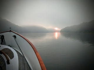
Dawn in Our Foggy, Cumberland River Anchorage

We're up with the sun because the Cumberland is long, foggy and deep and there are miles to Nashville before we can sleep (apologies to Robert Frost).


Drag Queen Anchor Alarm

The morning's first job is to turn off the anchor light.  After that I checked the anchor alarm to see how much we drifted from yesterday's set.   Depending on the scope, it's not unusual to move up to 40'.  Never have we moved zero feet, which was today's value.  That sums-up well the river anchorages, calm as sleeping at home.


Passing the Ronald L. Sensenbach and His 12 Barges

To paraphrase Justice Stewart, I can't define the difference between a well set anchor and a fouled one, but I know a fouled anchor when I see it.  Fighting for 30 minutes with a  bar-tight chain certainly isn't common.  Had this been a Clive Cussler novel, Dirk Pitt and Al Giordino would have pulled up a long-lost, gold-laden iornside...  Us?  We probably hooked a tree and it wasn't budging.


A Lot of River Debris

With amputation looming nothing's too crazy to try.   Powering Nellie forward with the hook down certainly qualifies as crazy.  Fortunately it worked.  We raised no gold, no iornside, just 40' of 3/8" BBB chain and a 35lb CQR anchor--about $500 retail.


In the Cheatham Lock Along with Ms Naomi

In the bucolic setting of Weaver Creek a train slides by and sounds its horn.  Nellie replies with one whistle.  The train then sounds its horn twice.  Nellie reciprocates.  The train counters with one long and one short blast.  Nellie's compressor comes on; the DC bus voltage drops; Nellie's autopilot does a hard turn to starboard, setting us on collision course with the riverbank; meanwhile Nellie's crew, with saucer-wide eyes, do a Three Stooges rendition of regaining control.  In the distance the train whistle can be heard sounding forlornly, and unrequited, one long and one short.


A Sentiment We Can Relate To

It was a rather busy day, but a satisfying one.  The heat has us seeking shelter in Nashville's Commodore Yacht Club.  Truth is what we seek is 120V power for the air-conditioner.  The Club's $1/16oz beer is an unexpected benefit.  81 miles today and 2,936 miles into the Journey.   DBH

Sunday, June 12, 2016

Day 185: Musselers


Shade Trees at Green Turtle Bay

  Before leaving Green Turtle Bay we pumped out the holding tank.  Nathan, a 20 something dockhand, helped us.  He's one of five or six musselers--professional mussel fisherman--that were put out of work by this year's moratorium.

  He said mussels were a good living.  The season is long and runs from Spring to Fall.  On average a crew of two splits about $800/day.  He's seen mussel prices oscillate widely from a low of 75¢/pound to a high of$10/pound.  With a sparkle in his eye he said the single day record was by a two-man crew who managed a $20,000 haul.

  Commercial musseling is done in about 20' of water.  Fishermen can either dive on the mussels and collect them by hand or fish from the surface using brail hooks.  Nathan described descending into a current laden, inky blackness, wearing 80 pounds of scuba gear, to grope the bottom in hopes of finding mussels.  Depending on current, temperature and other factors only about 1% of mussels are on the bottom's surface at any one time.  The rest bury themselves up to 7' into the bottom's mud.  Apparently the mussels can move fairly quickly.  Nathan was harvesting a rich area when a sudden current change caused the mussels to bury themselves.  "After that", he said, "there wasn't one to be found."

  Brail hooks have been around since 1897 and resemble one of the legs on a kid's jack.  When a brail hook is drug across a feeding, i.e. open-shelled mussel, the mussel slams shut.  Then, like a blue crab that won't let go of a chicken leg, the mussel's fate is sealed by the brail hook it captured.

  Nathan is ready to go back to musseling but he's unsure when, or even if the the fishery will open up.  "It may take a lawsuit." is one of the last things he tells me.


Patti's Restaurant a Local Favorite


Not All Wild Flowers Have Gone to Seed


Now Those are  Bird Houses!

Lake Barkley, the first of two Lakes we'll transit on the way up to Nashville, starts off every bit as big as Kentucky Lake.  However, by the time we get 60 miles up the Cumberland River it has narrowed considerably.  The 1mph current is still light, but now it's noticeable.


Tonight's Anchorage Behind Dover Island, Looking East Up the Cumberland River

Nellie's thermometer hit 102°F today.  I'm happy to report that an old dog can learn new tricks--we anchored in the shade!  It took 120 feet of chain in the 40 foot deep water, but it was shady water ;-) It's 59 miles from Green Turtle Bay, Kentucky to Dover Island, Tennessee, Cumberland River MM90.  The Journey's total is now 2,855 miles.  DBH

Day 184: Green Turtle Bay Marina, Kentucky


Really Big House Boats

It was an easy 11 mile trip today but it encompassed a major milestone.  For the first time since 29 April we're not on the Tennessee River.  Hello Cumberland River!  If I have my geography right Nashville is 160 miles upstream.

Green Turtle Bay Marina has quite a reputation.  We couldn't just pass it up; or its two pools, private beach, and restaurants.  At $1.25/ft it's little more expensive than average.  Still, we splurged for the $46.25 ;-)  For that price we also get electric.  Which means in today's 92°F temperatures, Nellie's air-conditioning is a nice treat.

Total miles into the journey is now 2,796.

Friday, June 10, 2016

Day 183: Six Months Aboard


Big Water at Tennessee MM58 Looking North

How big is Kentucky Lake?  It's 250 mile², a touch smaller than Lake Powell and a touch bigger than Lake Mead.  That makes it the 24th largest Lake in the US.


Nellie's Anchor Bridle

Just when we've gotten used to tight anchorages we end up in a huge one, like last night's Fort Heiman.  Fort Heiman is wider than much of the Tenn-Tom Waterway and wider than all of the Black-Warrior River!  At least I have a new appreciation for what a snug anchorage is.


The Air is 92°F, the water is 85°F--Ahh...


Shells on the Sandy Beach


Nellie with Her Sun Gear Deployed

This afternoon we dropped the hook in Smith Creek (MM30).  We picked this spot based on its protection from tonight's southerlies.  At 3PM we realized we could have chosen better.  The other side of Smith Creek was just as protected from the winds but it was also shaded by huge deciduous trees.  Note to self, when anchoring and all things are equal, pick the spot that gets the most afternoon shade. 

It was an arduous 31 mile day.  The total for the journey is now 2785 miles.  DBH

Thursday, June 9, 2016

Day 182: Land Between the Lakes

We got off the Pebble Isle dock at the crack of noon and are pleased for having done so. Procrastination is easy when the marina offers high speed internet--not to mention power, water, showers, and a courtesy car.

MM80--the Chart Says this is an Abandoned Pre-TVA Dock
We're approaching that magical vacation land known as the Land Between the Lakes.  The lakes in question are really the Tennessee and Cumberland rivers.  This knowledge may not be widespread based on the constant question from locals, "How did you get here?"

Mimosa, Fern and River, Johnsonville State Park

Johnsonville Collapsed Railroad Bridge Circa 1860's

Even Army Aviators Like Nellie--This Guy Did a Slow, Low, 180 degree Pass

Decay and Rebirth, Johnsonville State Park
Kentucky Lock and Dam are still 40 miles north but the Tennessee (aka Kentucky Lake) has widened tremendously.  It's easily averaging 1-1/2 miles wide.  It's also treacherously shallow out of the main channel.  I suspect that the TVA floods inundated what used to be low lying marsh.  That explains both the river's width and the shallow depths.
On the hook in Fort Heiman, Tennessee, MM62.  A short 34 miles today and 2,753 miles for the journey.  DBH

Day 181: Johnsonville New and Old


Johnsonville Supply Depot

Not more than a mile from Nellie's slip is Johnsonville, the site of an 1864 Union Army supply depot.   Bicki and I both spent several years as 'loggies'--military logisticians--and it's interesting to see that not much has changed, an army still runs on its stomach.  


Johnsonville Today

What is interesting is to see the strategic role the Tennessee River played in the war.  Since the Confederates couldn't defend it, the Union used the Tennessee as a Logistics highway.  It all but assured the Union victories at Shilo, Nashville, Chattanooga, and Knoxville.  A dagger in the heart of the Confederacy the river has been called.   Denied this highway, the Confederates were forced to move their materiel over miserable back roads, a slow and tedious process.

The two pictures above, taken 162 years apart, but otherwise similarly composed, show how much the TVA dams have widened the Tennessee.  Today it's 1.6 miles wide, in 1864 it might have been a quarter of that.


Follow the Moss Trail


Pepe Won't Develop Odor Glands Until 6 Weeks


Spring Flowers Yield to Summer Lichens


Johnsonville as Seen by Confederate Artillery Position on Pilot Knob

In November of 1864 Johnsonville was bombarded and set ablaze by Confederate Major General Forrest. Destroyed were between $2M and $6M of Union Supplies.  Both Johnsonville and the area the Confederates launched their attack from are now State Parks.

Still at Pebble Isle Marina, Tennessee.  No miles today and holding at 2,719 miles for the journey.  DBH

Tuesday, June 7, 2016

Day 180: Wheels or Altitude


Louisville and Nashville Railway Bridge

This bridge at Tennessee River MM100 used to be at MM22.  It was floated to its new location when the Kentucky Dam was completed in 1944.  The bridge looks old because it is old, and its only 25' above the water.  Nellie's air draft is 23-1/2'--I think.   We put the mast down; better safe than sorry...


Kentucky Lake is the Largest, East Coast, Man-Made Lake

At a dam's tail--the low water side--the river is usually narrow and its banks scoured.  Proceeding down stream the river widens and takes on the appearance of a lake.  Flooding is an issue at any point on the river but moreso just below a dam. 


Two Houses and Two Solutions

It was on the Kentucky Lake, just miles below the dam, that we started noticing how high the houses are built.  The house pictured above is easily 16' up.  But then we noticed something else; many lots didn't have houses, but house trailers under roof-only shelters (left side of the picture above).  Hmm, that's an interesting way to get around the building code.  Other plusses include lower taxes and insurance; lower maintenance costs; and if a flood threatens, simply move the trailer to high ground ;-)  The ingenuity award, however, goes to the guy that installed pilings on his lot and then tied a houseboat to them.  Always thinking these Tennesseans.

The plan was to anchor out tonight but then we came across Pebble Isle Marina, Tennessee (MM96): $1/ft; courtesy car; and fast wifi.  Yea, this is pretty much cruising heaven.  There is another motive for stopping here.  Trev Croteau splashed his LNVT Hjortie here before cruising her up the Mississippi to Lake Pepin (Mississippi MM776).  Since from here north we're following in Trev's wake, it's appropriate that we should begin where he did. 

It was a short 43 mile day.  The journey total is now 2719 miles.  DBH