Thursday, March 31, 2016

Day 112: Town Saved From Destructive Winds

The storm and its concomitant high winds went north of Biloxi.  Still, it was a windy day here so Nellie stayed tied to the dock.  Tomorrow's weather looks more promising. 


marinetraffic.com

Today was spent running cables and installing antennas for the AIS.  Nellie's realtime position can now be located on marinetraffic.com.

We're stuck in Biloxi but with luck, tomorrow morning, we'll be shoving off for Gulfport.  0nm today and 849nm to date.  DBH

Wednesday, March 30, 2016

Day 111: Destructive Winds?


Point Cadet Marina, looking SE

Thursday and Friday's forecast warned of "destructive winds."  I'm guessing that destructive winds are way over the 20kts we saw today.  That being the case, Nellie's very happy being securely tired to a dock.  The fairly well protected Biloxi Bay was full of whitecaps.  I can't imagine what it was like in the Mississippi Sound. 


First Course (of Ten)

But then why go cruising when it's 1/2 price buffet day at the Beau Rivage Casino?  They had deep fat fried corn on the cob.  No kidding.  It was actually pretty good.


Stilt House

I don't know if this was the last house standing or the first house rebuilt; either way, Katrina certainly changed the landscape.

At Point Cadet Marina.  Zero miles today (not counting all the bouncing in the slip) and holding at 849nm for the trip.  DBH

Tuesday, March 29, 2016

Day 110: Bouncing into Mississippi

Note to self:  Don't anchor anywhere in the Mississippi Sound and never again trust a weather forecast.

Last night's southerlies were supposed to become northeasterlies and moderate.  We planned accordingly and dropped the hook on the west side of Isle Aux Herbes.  Sure enough, the predicted northerlies started to blow, but from due north and with no moderation.  The two mile fetch gave the waves plenty of time to buildup before they got to us.  Suffice it to say, it was a wee bit bumpy last night.

Off before sunrise we crossed into Mississippi at dawn.  The Mississippi Sound is sneaky big.  It averages 10nm wide (north to south) but is 80nm long (east to west).  This morning we felt that length as the easterly winds had really stirred things up.


Our plan had been to run the length of the Sound today but good judgement diverted us into Biloxi, Mississippi.


Historic Site but the House is Gone

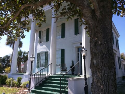
You can't walk around Biloxi and not see the devastating effect of 2005's Hurricane Katrina.  At first I thought the town had a lot of parks.  It turns out they're not parks, but rather empty lots where houses used to be.  Only one house in ten remains. 


Casinos Everywhere

Prior to Katrina, the law dictated that Biloxi's casinos had to be on barges. Katrina's washed the barges ashore where they pounded the town.  Not wishing a repeat the law was subsequentally changed and the casinos moved ashore.  The casinos now dominate the town. 


Today's run from Isles Aux Bumpy to Biloxi

At Point Cadet Marina (which was 30' under water during Katrina).  35nm today and 849nm to date.  DBH

Monday, March 28, 2016

Day 109: Sweet Home Alabama


Looking west across Pensacola Bay
This is a sight we haven't seen for a long time, clearing skies and no winds.  Thank you, thank you, thank you! 

Alabama/Florida line
At 11am we cross mile 170 EHL and enter Alabama.  I can't say it looks any different than Florida but there is a slight smell of fried food in the air ;-)

Yikes!  Big tug and barges.
The AIS spotted a tug six miles ahead of us and going the same direction.  As luck would have it we caught up to him in a narrow canal on the approach to Mobile Bay.  A two whistle pass (where we leave him on our starboard side) was offered and accepted.   Nellie is now one-for-one in the 'successfully passing tugs' category.  Break out the bubbly!

Looking west into Mobile Bay
Mobil Bay is a big body of water: 20nm east to west and 27nm north to south. The French named the Bay, Bon Secour (safe harbor).  They must have done so on a windless day as the Bay has a notorious reputation for being rough.

Oil Rig
The day is full of firsts, this time it's an oil rig.  We saw a handful of them in the south end Mobil Bay. 
It was 64nm from Pensacola Florida to Isle Aux Herbes in the Mississippi Sound, Alabama.  The hook was down at 1810 hours.  Cocktail hour started shortly thereafter.  DBH

Sunday, March 27, 2016

Day 108: Enough Already with the Rain

We need look no father than this dinghy to be reminded how much it's rained in the past three days.

Apparently we weren't the only ones suffering from cabin fever as the beach filled quickly once the rain let up.

Our forced hiatus ends tomorrow when we head towards Mobile Bay.  0nm today and holding at 749 for the trip.  DBH

Saturday, March 26, 2016

Day 107: Motivation

I've got to be really motivated to mess around in the rat's nest behind the Garmin navigation displays.  Well, I'm motivated now.  Last week we met a tug and its wide barge in a very narrow canal.  It reminded us of the importance of an AIS.  The AIS would have alerted each of us to the other's presence well in advance.  The pass could have been coordinated for a much wider area.  The good news is we have an AIS aboard.  The bad news is it's not installed.  When better to get the job done than a rainy day at the dock. 

At Sabine Marina in Pensacola Beach.  0nm today and holding at 749nm for the trip.  DBH

Day 106: Off Season

Looking west
I'm surprised at how few cruising boats we've seen.  Not that I'm complaining as there has been no competition for the anchorages or marinas.  Still, it gets a little lonely out here.
Funny how nomenclature changes from place to place.  The ICW has become the GIWW (Gulf Intracoastal Waterway).  One's location on the GIWW is measured in statue miles east or west of the Harvey Lock and is abbreviated as EHL or WHL.  Nellie's currently at mile marker 200 EHL. 

Gray day
After yesterday's weather fireworks it's actually nice to be becalmed in rain and fog.  The sight seeing isn't much but the stress level is way down.

Helpful sign on Pensacola Beach
At Sabine Marina, Pensacola Beach, FL.  30nm today and 749nm to date.  DBH.

Thursday, March 24, 2016

Day 105: Nasty Weather Day

Scenes like this make me realize we're only a broken bilge pump away from being homeless.

There's a nice park right off our dock.  We explored it and walked over to the beach.

The waves were up and the weather threatening.  The downpour and accompanying thunder and lightning started at 3pm.  Now, four hours later, it hasn't let up.

Very happy to be at the well built, free dock in Fort Walton Beach.  20nm today and 719nm to date.  DBH

Wednesday, March 23, 2016

Day #104: Where to?


Westward ho!
The goal of this westward adventure is to replace our chart's terra incognita with memories (preferably good ones).   However, West is a direction, not a destination.  That was the conundrum this morning as we laid out today's route. 

The Grand Cayon
The 17nm canal connecting the West and Choctawatchee Bays is colloqually known as the Grand Cayon.  The name didn't make sense until we we came upon some red, runneled, sandy banks interspersed with pines.  Even so, the name is a bit of stretch :-)

Today's route
So, what was today's destination?  Hogtown Bayou.  It wasn't the name that attacked us but rather the anchorage's protection from southeast winds.  45nm today and 699nm to date.  DBH

Tuesday, March 22, 2016

Day 103: A Proper Fog


Bicki on watch
Our fog training wheels are off.  This morning's visibility was less than 50'.  While hugging one bank in this narrow river the opposite bank was completely shrouded.

Pilothouse vs. camera view
Nellie's forward looking camera was surprisingly good at seeing through the fog.  It's aboard to help with night navigation.  Who knew it could play a role in the fog?

An ethereal perspective on the quiet and foreboding swamp.

When the fog finally lifted it was a beautiful day.

Into Central time
At White City Nellie crossed into Central time.  This marks the first time she's transited a time zone under her own power.  She was robbed of this distinction while exploring Alaska in 2007 because the people of Southeast selfishly opted to remain in the Pacific time zone :-)

Today's route
I'm happy to report that the ham radio that continuously broadcasts Nellie's position is back on line.  A nameless someone accidentally unplugged it's power cable while trying to fix the anemometer. 
At anchor in Masalina Bayou, Panama City, Florida.  34nm today and 654nm to date. DBH

Monday, March 21, 2016

Day 102: Up the Apalachicola River

Quaint, frontier, antebellum houses are plentiful in Apalachicola.  This port town boomed by shipping out cotton.  Later it was made irrelevant by trains. 

Lots of dredging activity along the river.  In the distance a big grass fire is fanned by today's high winds.


Today's high wind predictions

Windfinder.com has become our go to wind prediction site.  Unlike marine weather stations which look at wide swaths of territory, Windfinder has a much finer granularity.  The question used to be, what is the wind prediction in western Florida?  Now we ask, what are the winds going to be in Apalachicola and in White City?  Since these two cities bound today's route, we good feeling of what to expect along the way.

The Apalachicola Northern railroad bridge stays open unless there's a train coming.

Things break aboard a boat.  On a good day we fix things as fast as they break.  I'm not sure how today will turn out.  The windvane is currently in pieces as we try to figure out its problem.  The washing machine is working again now that the waterline filters have been cleaned. Finally, the radio that reports our position won't turn on.  Oh well, what would cocktail hour be without a screwdriver and a manual in hand?

It's a pretty waterway but a little disconcerting that the chart labels the area 'unpenetrable swamp'.  Is it a warning for mariners or hikers?

At the free dock in White City, Florida.  19nm today and 619nm to date.  DBH

Sunday, March 20, 2016

Day 101: Enjoying Apalatchicola

Today was R&R with a purpose; namely waiting out tonight's projected 30mph winds.  We might go swimming--or not.
At the Water Street Hotel and Marina, Apalachicola, Florida.  0nm today and 600nm to date.  DBH

Saturday, March 19, 2016

Day 100: As the anchor drags...


Looking SE in the Carrabelle River

Didn't I mention anchor dragging just the other day?  Well, it was our turn.  The good news is it happened at 9:30am instead of the usual o'dark-thirty.   It's always fun re-anchoring in 20+ kt winds.  Practice makes perfect.


Burned and sunk in Carrabelle

It appears the building burned and then collapsed onto the boat.  Ouch!


1kt current in the St. George Sound

We've timed our arrival in Apalachicola for slack tide.  The one knot lift we're getting in St. George Sound is just icing on the cake.


Carrabelle to Apalachicola

At the Water Street Hotel and Marina, Apalachicola, FL.  25nm today and 600nm to date.  DBH

Friday, March 18, 2016

Day 99: Where are we?


Huge live oaks in St. Marks
We took a slip last night in St. Marks' Shields Marina; at $0.60/foot how could we not?  For reference, in Tarpon Springs we paid $2/ft. 
The remoteness of the 'Big Bend' towns is palpable.  It starts by noticing there's no cell coverage and is reinforced when a walk around town takes only minutes.  What's amazing is that St. Marks is only 14 miles from Tallahassee.

South in the St. Marks River
Where are we?  The sun is out, the wind is down and the seas are calm as we leave the St. Marks River.  This is a real dichotomy from yesterday's adventure in thunderstorms and fog. 

Dog Island where the GICW begins
We made it.  As we reach Dog Island Florida's Big Bend, and all of its open water, is officially behind us.  Ahead is Carabelle where much of the southbound fleet stages.

Nellie's anchorage in Carrabelle
On the hook in Carrabelle, FL.  45nm today and 575nm to date.  DBH

Thursday, March 17, 2016

Day 98: This is Thursday, so this must be St. Marks...

So how do boaters celebrate St. Patty's Day?  By 'bearing off the green'.  Is that groaning I hear?  Apparently my proposal to the Coast Guard, to honor the day by painting all the red nuns green, has fallen on deaf ears. 
Fog.  Now rain.  What's next, locusts?  The radar screen, pictured on the left, shows us in the midst of rain showers with a thunderstorm 5nm off to starboard. 
What's very different about this coastal region is the long  harbor approach channels.  For example, once we reached St. Marks' outer marker, we were still 10nm away from town.  What's nice about these long approaches is that the wave height decreases the closer in you get.  This is the very antitheses of a bar crossing.  I'm good with that :-)
St Marks is the St Augustine of Florida's Gulf Coast.  It too was conquered by conquistadors; settled by the Catholic Church, taken over by the British; and on the side of the South in the Civil War.  So much history, so little time to study it all.
56nm today and 530nm to date.  DBH