Day #20: The winds have been blowing a sustained 25kts. Thinking that it might be a local phenomenon we drop the mooring ball in Little Farmers and head north. Sure enough, the winds decrease to 15kts once we clear the slot between the cays. The easterlies are blocked by the islands so the seas around us are realatively calm. And so it stays all the way to the anchorage at Big Majors Cay. In a pouring rain we drop the hook next to Egret, a Nordhaven '46. Not long later we see Egret's crew braving the weather and heading our way in their dink. After inviting Scott and Mary aboard we all sit down with some hot tea. Hot tea, in the Exumas, in late April? These cool, 69F, temperatures can't be normal. Egret left the States seven years ago and has completed a circumnavigation. Not many trawlers can make that claim. Scott and Mary regailed us with some great stories and the afternoon passed in a blink.
It was raining and blowing so hard that a little green bird with a yellow breast took refuge on Nellie and stayed aboard well into the night. Dancing on the hook in Big Majors Cay. 17nm today and 445nm thus far. DBH

Monday, April 30, 2012
Water, water everywhere and not a drop to drink
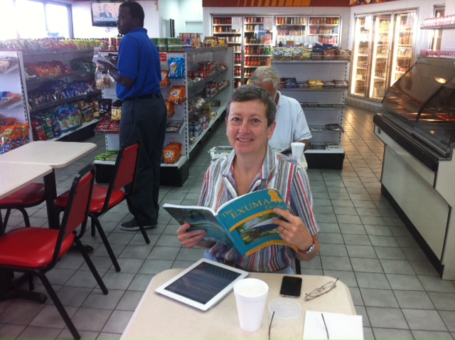
Day #19: We get underway early from Black Point. Our anchor comes up with a conch attached. Hmm, conch fishing is illegal for non-Bahamanians... Today's destination, Little Farmers Cay, is the southern terminums for our trip. From there to Georgetown, which is the largest city in the Exumas, the anchorages get scarce and exposure to the open ocean is plentiful.
The rapid currents in the Exumas are well documented but must be experienced to be believed. The almost 3' tidal swing has water constanly rushing in or out of the cuts between the cays. The Yacht Club in Little Farmers is located on a narrow stretch of water bounded on the east by Great Guana Cay. The waters between the two cays seem always in a hurry to go somewhere else. We approach the Yacht Club bucking the stream.
It's been 10 days since we last filled Nellie's water tanks. The water pump's frequent cycling warns that we're running low. Most all potable water here in the islands is obtained via reverse osmosis. This is energy intensive, read expensive, but does produce good water. Since Nellie doesn't have a watermaker onboard we must purchase it; the going rate is $0.40 to $0.50 per gallon.
It's the need to fill our water tanks that finds us bucking the current into Little Farmers. The dock is slightly askew to the stream and so the landing is more difficult but ultimately successful. The current pins us to the dock making it impossible to place fenders. After talking to Roosevelt, the Club's owner, we taste his water, take a picture of his water meter reading, and put 90 gallons into Nellie's tanks. Coming from the land of free water I thought I'd be irritated by having to pay $36 for it here. Nope. In fact, considering how essential water is, I'm surprised it's not more expensive.
I'd thought that 37' LNVT's carried 140 gallons of water. But being able to put only 90 gallons into almost empty tanks has me questioning the tanks' true capacity.
On a mooring ball in the fast flowing 'river' off Little Farmers Cay. 10nm today and 428nm so far. DBH
Saturday, April 28, 2012
Bread delivery

In our anchorage is a classic 50' wooden yawl whose best days are behind it. Aboard are four young people working hard to keep it afloat. Two of the crew visited us offering to sell freshly baked rosemary bread. Today's picture is of the bread's dinghy-to-dinghy pass off ($5 for a big loaf--very good too).
In a light rain we left Staniel Cay and worked our way 10nm southeast to Black Point. Black Point is the second largest settlement in the Exumas. Walking around the village you get a sense for how hard life is out here. 10nm run today and 419nm total. DBH
Friday, April 27, 2012
Dinghying with swimming pigs ...

Thursday, April 26, 2012
Look honey no hands ...

Compass Cay has the same wide-eyed allure for cruisers that Disney World has for eight year olds. And Compass Cay is today's destination. We exit the highway and head for the cay's north end. Like the other cays so far it is low, windswept, and covered with dwarfed, dense vegetation. The water is colored glorious shades of blue. Protected by reefs the seas have settled and only wind driven ripples disturb it. To port we see deserted white sand beaches which breakup Compass Cays rocky shoreline. The magic begins when we round the cay's southern tip. Ahead is nothing but calm well protected water. A solitary sailboat lies at anchor in a setting worthty of a postcard. Just beyond is a hidden cove. Approaching it we can see about a dozen yachts clustered on Compass Cay Marina's trident-shaped dock. Being true cruisers we always prefer to anchor out--well, almost always ;-)
Today's picture shows the nurse sharks being fed here in the marina. The family of four, regrettably down to three now, appeared to be having a good time when this picture was taken. Safely at the dock in Compass Cay. 13nm today and 396nm thus far. DBH
Scary Clear Water

Leaving Compass Cay we stick to the VPR (visual piloting rules) route south. This route is a lot of fun because it keeps you in the thick of the cays. It's also challenging as there are no channel markers and many things that need to be dodged. Some of the cays are privately owned and have beautiful houses on them. One house had three huge wind generators providing electrical power. After a too short four hour cruise we arrived at Staniel Cay, the largest settlement in the northern Exumas.
Getting an anchor to work in the Bahamas is a challenge. The anchor's flukes penetrate the sand but not the hard pack just below it. While the sand alone gives the impression of a well set hook, it doesn't hold in a blow. Some LNVTs came with a Taiwanese knockoff of a Danforth anchor. Nellie's got one: it's 45lbs, stainless steel, well made, and has 'Taiwan' stamped on it. After having used it for a year now the conclusion is that it works fine--in other than flat smooth bottoms. Today, for example, we couldn't get it to set off Staniel. Even diving on it and manually directing the flukes downward didn't work. Interestingly, we were successful in setting a Fortress (a Danforth by another name but made of aluminum). The anchors appear similar but their individual nuances spell the difference between success and failure.
We dinghied ashore and walked on our first paved roads in what seems forever. Colorful, small, buildings are scattered about. The building colors are used in lieu of a business' name. For example, there's a pink grocery, blue grocery, and yellow bakery. It's about a mile walk to Isles, the island's largest store. Large is a relative term, think two car garage size. Three bananas and a loaf of Bahamas white sandwich bread was $7.
Walking back we stopped for beers at the Staniel Key Yacht Club. This is where the cruising set hangs out and we talked with the crews off three different boats. It never ceases to amaze me how interesting these folks are. 12nm today and 408nm total. DBH
Monday, April 23, 2012
Wind and Rain
Day #13: We're still holed-up in Warderick Wells Cay. The cold front is nearing and the winds are getting stonger and clocking. Boat projects, reading, and debating world issues easily fill the day.
Being afloat connects you intimately to the weather. As the wind clocks we know the low is moving. Fast moving thunderstorms are a very visible manifestation of the movement. We've had some very close lightning strikes and buckets of rain. 0nm today and 383nm so far. DBH
Being afloat connects you intimately to the weather. As the wind clocks we know the low is moving. Fast moving thunderstorms are a very visible manifestation of the movement. We've had some very close lightning strikes and buckets of rain. 0nm today and 383nm so far. DBH
Saturday, April 21, 2012
The Hike
Day #12: Roderwick Wells Cay is about two miles long. Nellie is currently riding to a mooring ball on its southeast side. Today we decided to trek the length of the island. On a map this looked fairly straight forward. Reality was another matter. First of all cenotes, deep water filled holes, litter the island so you must always look down or risk falling into one of them. If the cenotes don't get you, the ubiquitous limestone, which everywhere has erroded to knife-edge sharpness, surely will. So how bad can a two mile hike be? It took an hour and a half, walking at a healthy pace, to go one mile. At the halfway point we found ourselves standing atop a hillock where we could see both Nellie and the north end of the island. We debated going on but realized our little hike would turn into a 6 hour affair. With the siren call of cool drinks waiting aboard Nellie we retraced our steps. Within 100 yards of the trail's beginnng we ran across other cruisers just starting the hike north. One woman in their party was wearing high-heeled sandals--clearly the wrong shoe selection ;-)
The winds are building as the front approaches. Happy to be on a mooring ball in Roderwick Wells South. 0 nm today and 383nm total. DBH.
The winds are building as the front approaches. Happy to be on a mooring ball in Roderwick Wells South. 0 nm today and 383nm total. DBH.
Friday, April 20, 2012
Watchadarocks
Day #11: The Exumas are amazingly shallow. Today's trip south saw as weaving in and out of many rocks and Cays. We're using our water reading skills to keep Nellie in deep-enough water. Our charts are very good and this helps build confidence. Our current plan is to head to the south end of the Exumas, about 120nm away, and then slowly work our way north. There was a 15kt wind which we beat into for most of the day. Nellie does great cutting through the 2' swell.
Once again a storm is threatening. Big winds are expected on Sunday and Monday. We're tucked into a well protected anchorage on the south end of Warderick Wells and plan to stay put until after the low passes through.
It's amazing how vibrant the colors are here. Sea, sand, and sky combine in a magical way. The Cays are mostly rock but beautiful beaches abound. I'd expected more palm trees but instead there's a low, scruffy vegitation. 36nm today and 383nm total. DBH
Thursday, April 19, 2012
1nm
Day #9: Baby steps, that's what today's 1nm round trip to the fuel dock was, a baby step. Even so, it was good to have Nellie out moving. Diesel is $5.40/gallon. When I tried to pay the bill both my credit cards rejected the charge. Seems the card companies don't like to see $400 fuel charges from foreign countries. It was then a mad scramble but we came up with the cash. A wifi Skype call from the Texaco station to both credit card companies got the cards turned back on again. It's such fun trying to clear up financial problems when out of the country ;-) John has returned from Naples and so the crew is looking forward to tomorrow's planned departure for the Exumas. We had a very nice dinner with Penny, Stewart and their friend just in from Scotland, Alastair, aboard the sailing vessel Stravaigin. 1nm today and 314nm total but still in Nassau.
Swallens Cay, Exumas
Day #10: We finally were able to break away from the dock in Nassau and and cruise southeast to the Exumas. It was a little bumpy leaving New Providence Island and Five Fathom Bank lived up to its reputation of short, steep waves. The closer we got to the Exumas though the calmer things became. A last minute decision, based on the south winds, had us duck into South West Allens Cay. Our Garmin charts have a typo and call this Cay Swallens, which I kind of like better. So here we sit in an idylic anchorage--white sand beach close by and clear light blue water all around. Welcome to the Exumas! There's no picture with this posting as it's being sent from Nellie via HAM radio (Winmor)--no wifi out here. 35nm today and 345nm to date.
Wednesday, April 18, 2012
Texaco Wifi
Weather is starting to clear... Still in Nassau. 0nm today and 312nm total.
Tuesday, April 17, 2012
Bahama Breads

A universal feature of all cultures seems to be bread. Often it's quite different from country to country and that's what makes it fun to sample. So, our first quest this morning was a small bakery, tucked into a quiet neighborhood, that had been recommended to us. At first sight the bakery appeared to be shuttered. Then, as we approached the front door, a passing taxi slowed and the driver indicated that we should go to the side of the building. The door on the side didn't look any more promising, but since there wasn't a door on the back of the building, we entered it. Instantly we found ourselves belly-to a dough rolling table. On top of the table were many mounds of dough being sectioned into dinner rolls by an elderly man. Surrounding us and lining the walls were what appeared to be hundred year old mixers. A smiling woman approached and asked what we'd like. Mind you, there was no display case of goodies or straw baskets of bread from which to choose. Uncertain of exactly how to proceed, I asked what they had ready. Sandwich white and wheat loafs, twists, croissants, and ham and cheese rolls was the answer. Our twist and ham and cheese roll came to $3. The twist is a rather good sugar glazed churro. The ham and cheese roll, which is good too, is basically a dinner biscuit with the ham and cheese baked in. While these are nice snacks, the Bahamas wasn't built on them. Our quest for the bread at the heart of the Bahamas will just have to continue.
Prices here are generally a lot more than in the US. A quart of motor oil is $10 (vs $2 in the US), a gallon of diesel is $5.60 (vs $4.20), and a Nestlé Nutty-Buddy ice cream cone is $3 (vs $1.50). Conversely, a gallon of antifreeze is only $6 (vs $10).
Still pinned down in Nassau but enjoying the bread. 0nm today and 312nm total. DBH
Sunday, April 15, 2012
Paradise Island

Tony off Peacock stopped by to say hello. Peacock was about an hour ahead of Nellie during Friday's miserable crossing. We commiserated via VHF during the event. It's always nice when you're in the thick of it to hear a friendly voice. Still in Nassau, 0nm today and 312nm total. DBH
Saturday, April 14, 2012
We like white ...

One of the tools we use to determine if we're going to sea or not is a Surface Wind Forecast. It shows the wind speed in a given area by using colors. We like white the best, winds less than 5 kts. Light blue, winds at 5 to 10 kts, will also encourage us to go cruising. The darker blues, winds 10 to 20 kts, make us think twice. And green, an otherwise nice color, which represents winds from 20 to 25 kts, will keep us hugging a dock. And since today's picture shows Nellie completely surrounded by green, we didn't even think of casting off the dock lines. Instead we relaxed and met our boat neighbors Penny and Stewart who are both Scottish but have lived in Newfoundland for the past 35 years. They spent last month cruising the Exumas and so filled our imaginations with adventures to come. Tied comfortably to a nice strong dock in Nassau, 0nm today and 312nm total. DBH.
Friday, April 13, 2012
That was ugly!

We must have lived because today's picture shows Bicki happily changing our yellow quarantine flag for the Bahamas courtesy flag. We have officially arrived! A very bumpy 40nm today and 312nm total. DBH
Thursday, April 12, 2012
Wet Deck Day

Last night, and for the second day in a row, our 'anchor down before nightfall' rule was violated. At around 10pm we dropped the hook on the east side of Gun Cay (8nm south of Bimini). What's amazing to us though is after only two days underway from Naples we're in the Bahamas!
Today we crossed the 55nm wide Bahama Bank from west to east. The Bank's waters average 10' deep but to a vigilant mariner appear always to be much shallower. The white sandy bottom gives the clear water a beautiful blue-green hue. Since crossing the Bank can only be done safely in a few areas we saw at least half a dozen boats following the same track as Nellie. Their company did breakup what otherwise would have been a featureless eight hour run as just water and sky inhabit this part of the Bank.
The Chub Cay Club is where Nellie's moored this evening. Her crew spoiled themselves with dinner ashore which included red snapper and conch fritters. 175nm in the last two days and 275 miles thus far. DBH
Wednesday, April 11, 2012
Arrive in the Keys

Tuesday, April 10, 2012
Bahamas Bound -- 2012
Subscribe to:
Posts (Atom)